Memorial Day Weekend 2018
We originally intended to go to Early Winters Creek Campground in Mazama but were delayed in getting out of town. I had really hoped we would get a spot at Early Winters Creek, it is only about 15 miles or so from Washington Pass and I wanted to give the splitboard I just finished putting together a go but when we finally did get to Mazama all the campgrounds were full so we headed out to Winthrop and up towards Billy Goat Mountain until we found a spot.
One of the routes that I like to take youth groups backpacking on is a loop from Billy Goat Mountain around to the Hidden Lakes via Dollar Watch Mountain and back to Billy Goat. In 2017 there was a wildfire in that area that burned over 128,000 acres. I was (and still am) concerned about the how the fire affected the areas we like to hike through. Part of the reason for my concern is that there is a section of trail from Dollar Watch Mountain to Big Hidden Lake that had previously burnt out about 18 years ago and had become a miserable slog through overgrown underbrush and blowdowns. I am holding out some hope that the areas that burnt in 2017 won’t be as bad as the other area, due to the forests in most of those areas being in better shape than the area that had previously burnt which been affected by beetle kill and the forest there was already largely dead when the fire came through with devastating effect.
Since we were in the area I decided we would head up and hike up to Drake Creek or up to Billy Goat Pass, however it was not to be as the road was closed a couple miles before the trailhead with a sign that indicated closed meant closed to everybody not just vehicles. The closure was just past the Copper Glance trail so we decided instead to go up Copper Glance. I had thought I left the maps in the trailer back at camp so we went from what I could remember, that roughly we’d go up 2000′ and the trail was a couple of miles long. No big deal…
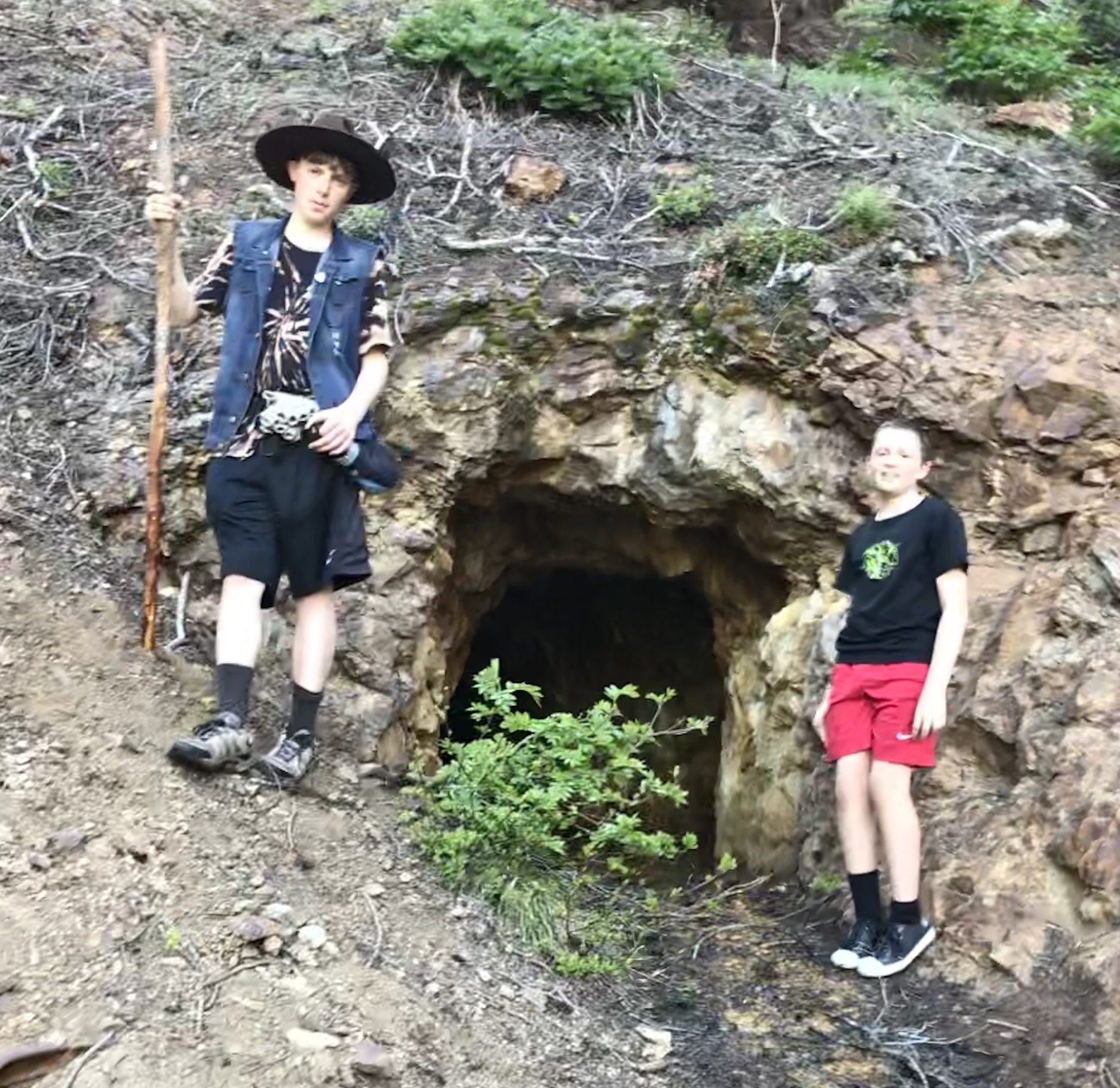
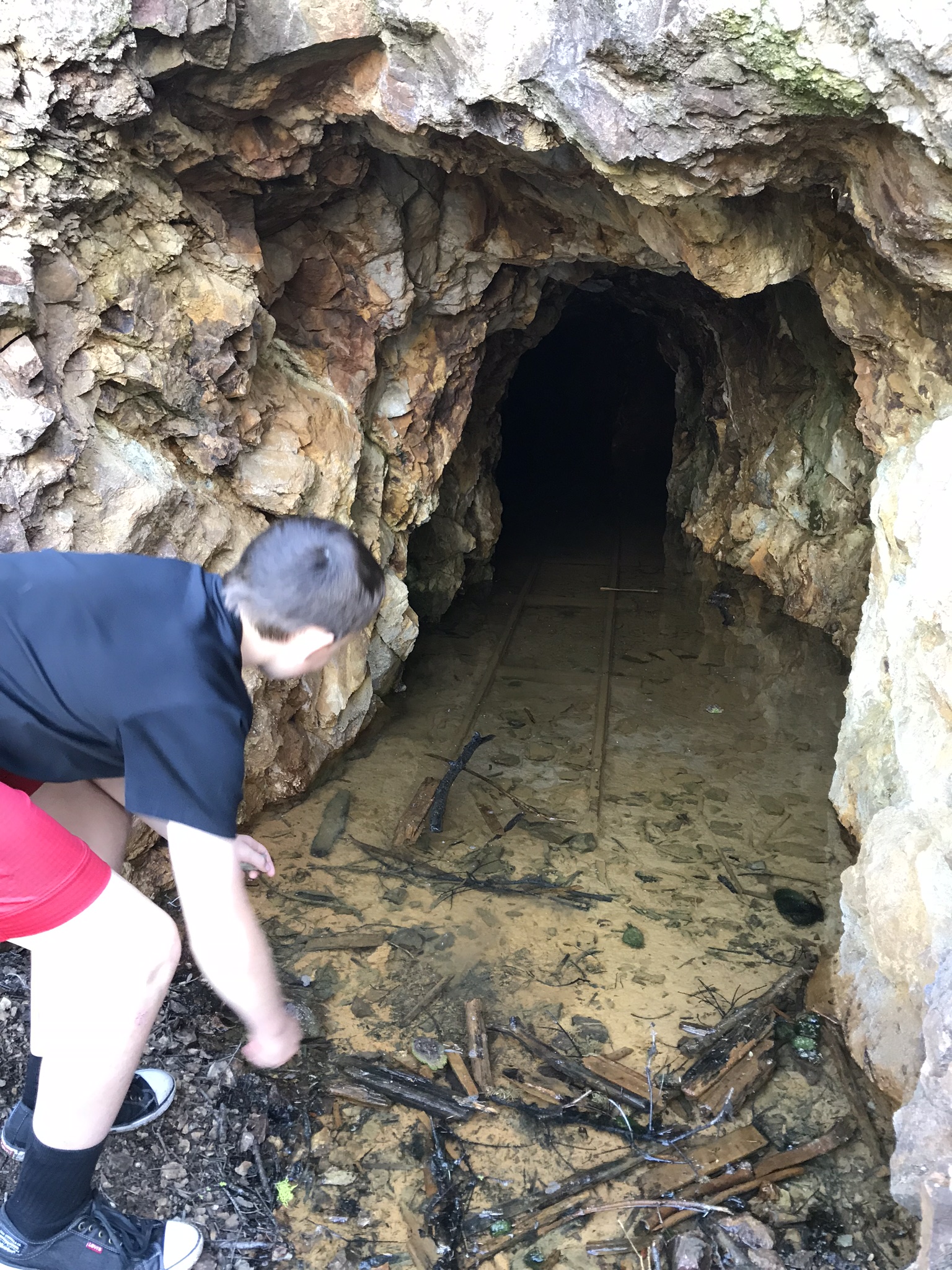
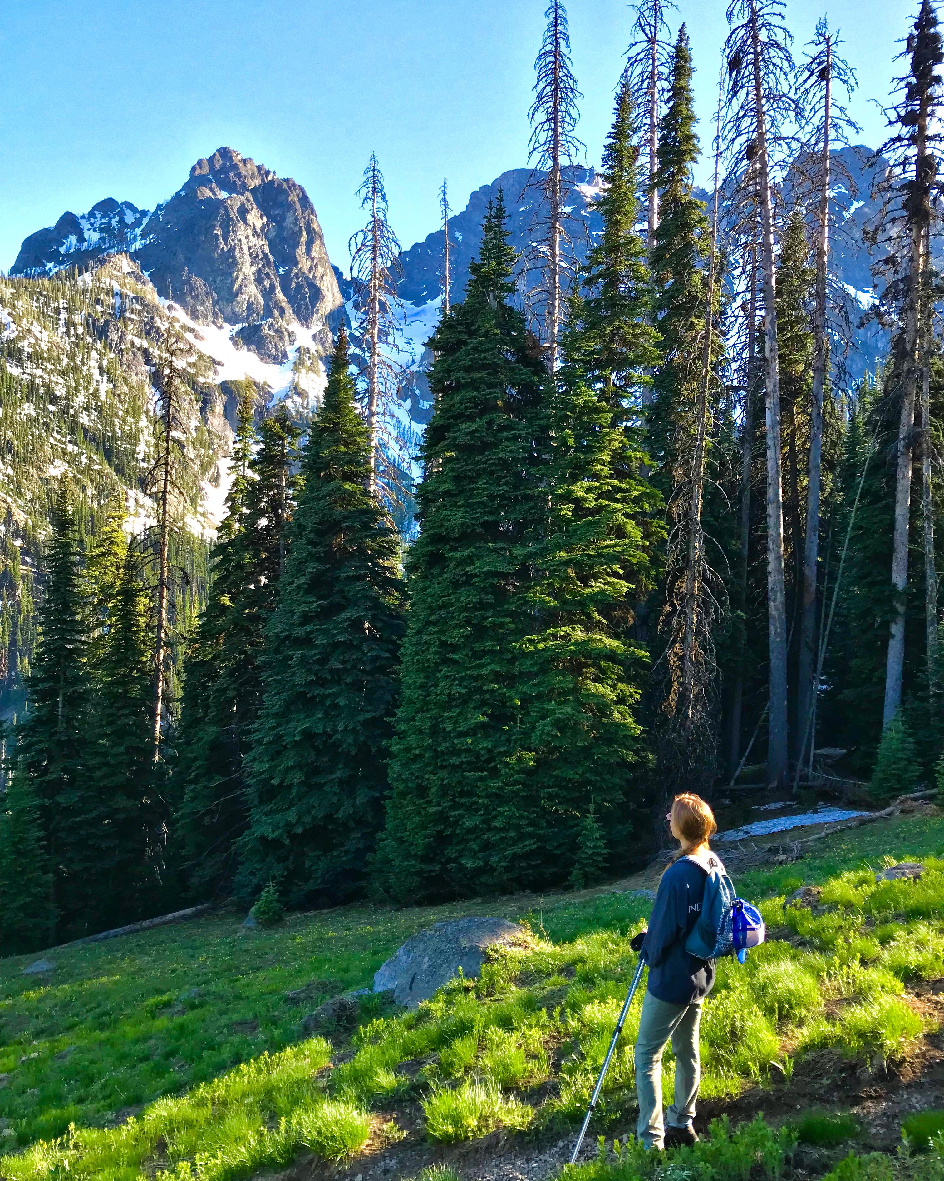
The first mile or so wandered through the woods up an old mine railway grade, eventually coming to an abandoned mine. It is a nice broad trail that while continually going up was not too steep (rail grade), there was a creek crossing that had Charissa a little concerned but none the less a pretty easy jaunt up to the mine. After the mine the trail steepens as you climb through the forest, I was beginning to wonder if we were going to break out of the trees and get a view when suddenly we came up around a bend and were rewarded with this amazing view (thank you to the other hikers that said keep going it is worth it, not that we would have stopped but it is nice to have some encouragement).

We continued to hike through the meadows enjoying the alpine views when shortly we began to come into some snow. As we entered back into the trees the snow became heavier and heavier making trail finding difficult. Eventually we came to a creek that looked like it would require a pretty significant effort to cross and we were pretty much on solid snow by then. As we had started out for just a leisurely stroll through the woods we weren’t really equipped to be roaming around in the snow and decided that it would be a good time to turn back. It of course was a hard decision as there is a lake up there that I really would have liked to reach even though chances are it was probably still snowed in or frozen over, but Zach was wearing converse tennis shoes that were soaked through and like I said we didn’t have the map with us…
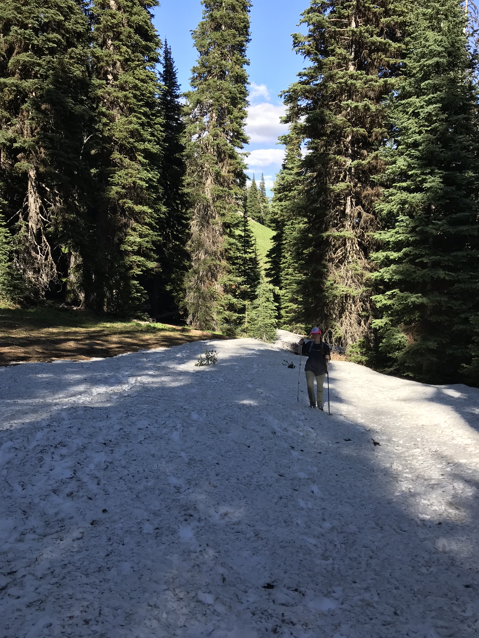
We hit snow! 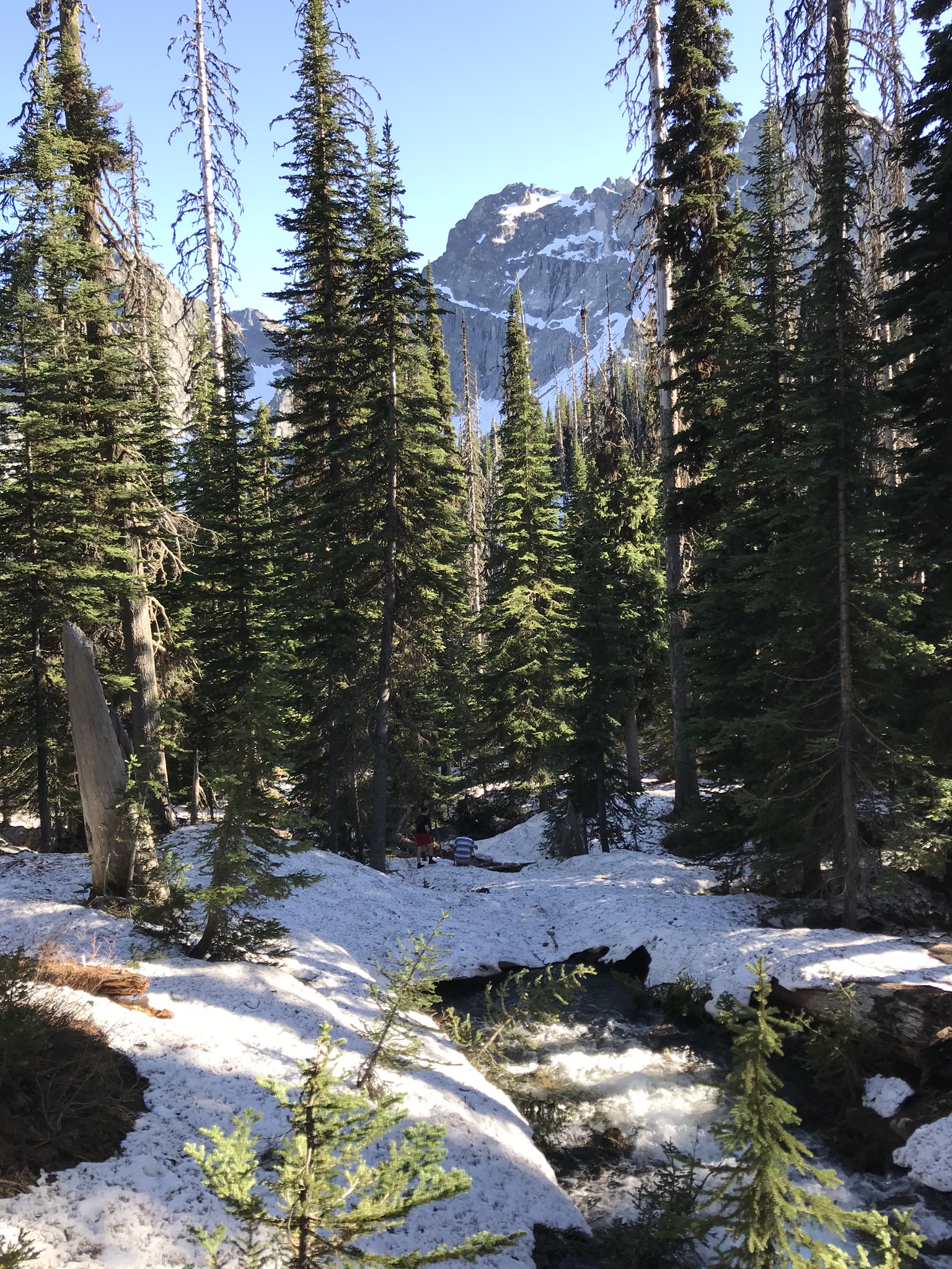
Zach, Gordon, and Skyler taking a break down near the Creek where we turned around
A couple of things about this hike:
While I don’t remember now how long we were up there I kept wondering why we hadn’t reached the lake, I could remember that it was about a 2000′ vertical gain and had been consistently hiking at a 1000′ plus gain per hour on other recent hikes (I know because we were measuring for that in preparation for a Mt. Baker climb) and we had been hiking for more than a couple hours. Turns out that on the map the trail doesn’t start from the road (like it does in reality). The map shows a road that goes in, probably about to the mine, then the trail starts. It shows the trail starting at 5000′ going up to 6200 feet in 1.8 miles and then dropping to 6100 feet in another .5 miles to the lake. The elevation of the road at the junction of road 5130 and 505 (which is really the trailhead) is 3840′. We made it up to 6,080 feet. Washington Trails Association puts the hike up to the mines at about 1.5 miles.
After returning to the car, and somewhat ironically, I found that I had not left the maps at camp but that they were in fact in the car….. Oh well maybe we’ll get to go back although as I wrote this the fire map shows that the Mcleod fire has reached the trail head and part of the trail.
While we didn’t plan on doing this particular trail and in fact had no intention of being in the area, it was a really enjoyable hike that I’m excited to go back and do when we can get to the lake. Sometimes you just get lucky 🙂
Trail Beta: Copper Glance Trail is Trail 519, off of Rd 505 (which is closed) take Road 5130 to get there, there are signs on the road. Use green trails maps 19 Billy Goat Mountain and 51 Mazama