Zach’s First Backpacking Trip at an Amazing Hiking Route Located Nearby.
As you may be aware this summer Charissa and I volunteered to take a group of young women on a 4 day backpacking trip. As part of the preparation for this trip we did a series of overnight trips that increased in difficulty as we prepared for the longer trip. After the 2nd overnighter we asked if any of the girls had a hike they would like to do and one of them said that they had done a route called Chain Lakes near Mt Baker and would really like to do it again.
I looked it up and it had good reviews, although it was a little shorter than what I had hoped we would do on this hike, the last before the 4 day hike, we decided to go ahead and do it anyway.
In researching the hike the reviews I read pointed out that it is a well traveled area and a popular hike, because of that camping is only allowed in designated areas. After the previous hike to Lizard and Lily Lakes where we almost didn’t get a campsite this had me a bit worried but luckily one of the fathers in our group volunteered to head up early with his daughter and secure campsites for us.
We chose to start at the parking lot for Artist Point. For those of you that aren’t familiar with this area this is the same area as the Mt. Baker ski area, from Bellingham you drive out about an hour to the end of highway 542.
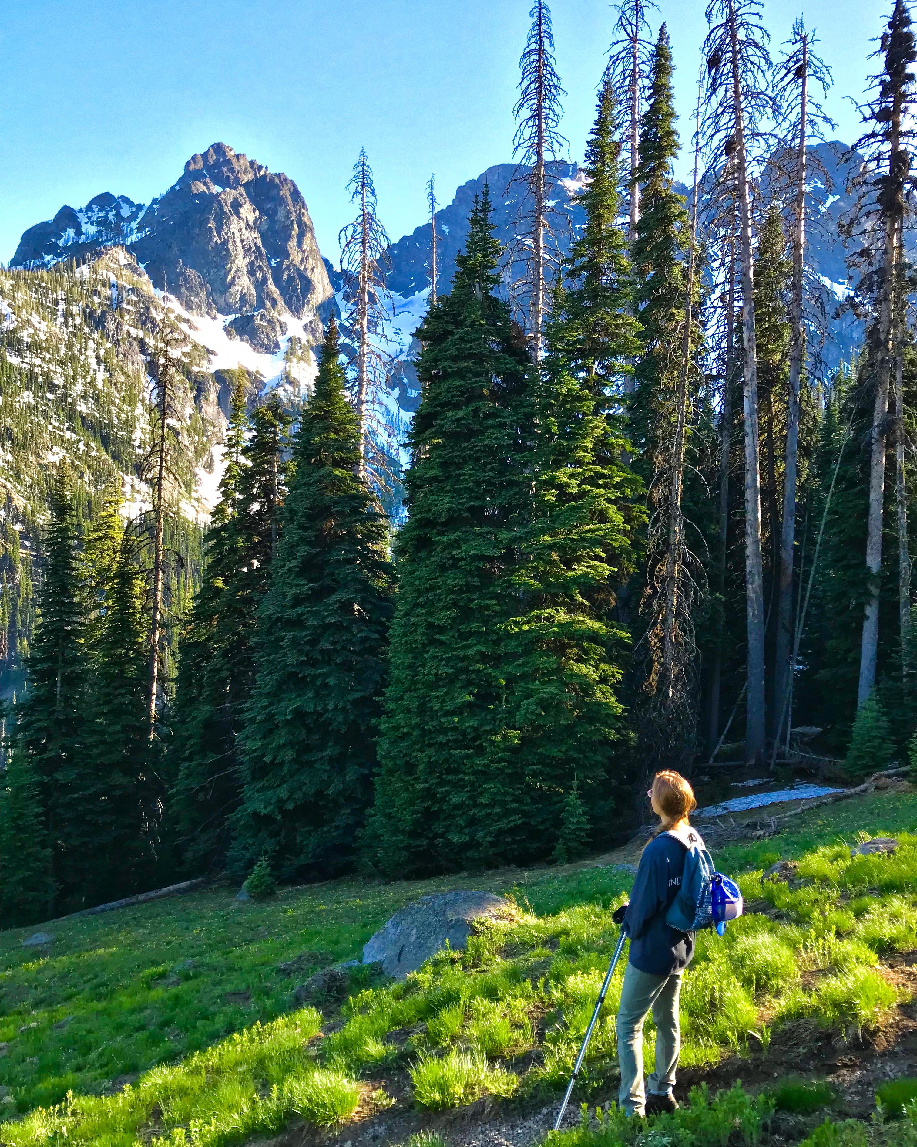
Mt. Baker ski area is not really on Mt. Baker but is located between Mt Baker and Mt. Shuksan. Mt Shuksan is a beautifully rugged peak with a glacier and ice falls that captivate the attention and overlook the ski area.
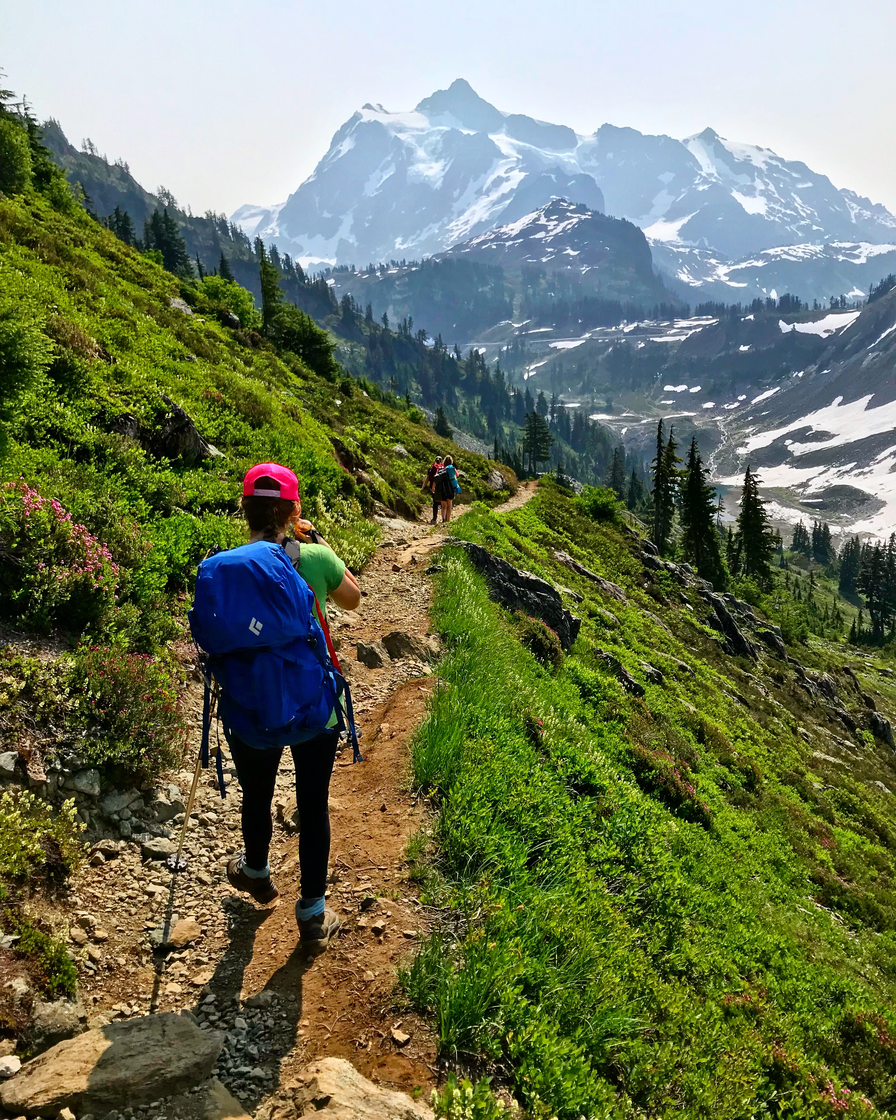
The trail starts at the southwest corner of the parking lot and traverses the slope from the top of Table Mountain that falls into the Swift creek drainage.
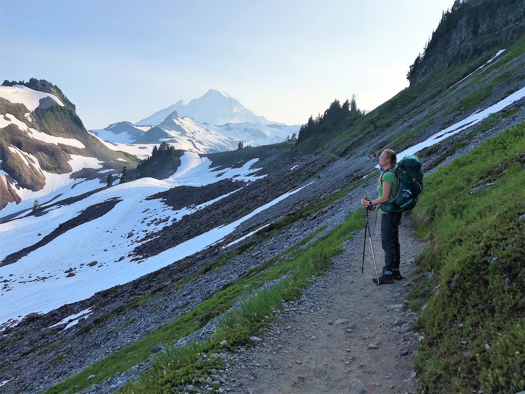
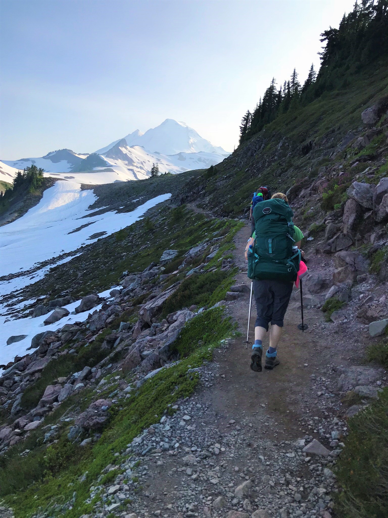
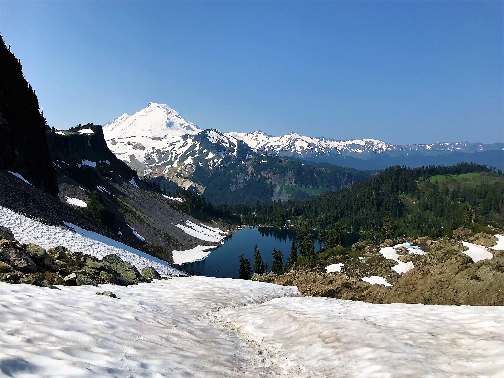
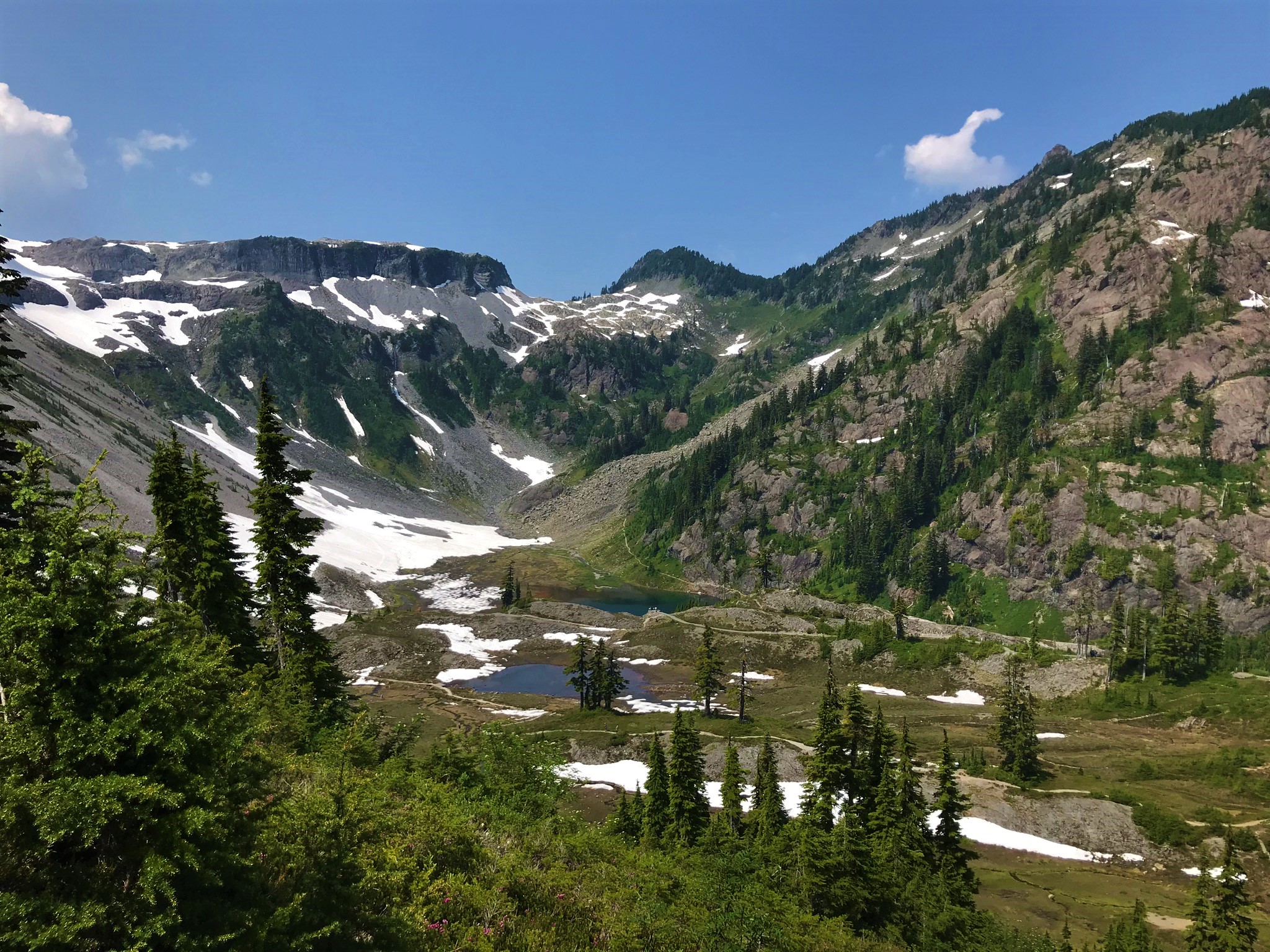
Almost immediately after leaving the parking lot we were treated to amazing views. This trail follows Ptarmigan Ridge onto Mt Baker and you can see right up onto the mountain. Looking to the left down the creek you can see Baker Lake, around 4,000 feet below the trail and about 8 miles away. The scale is stunning.
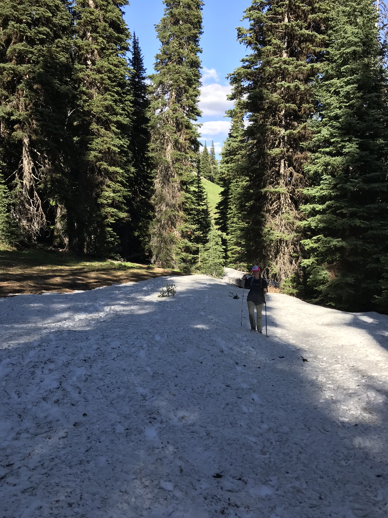
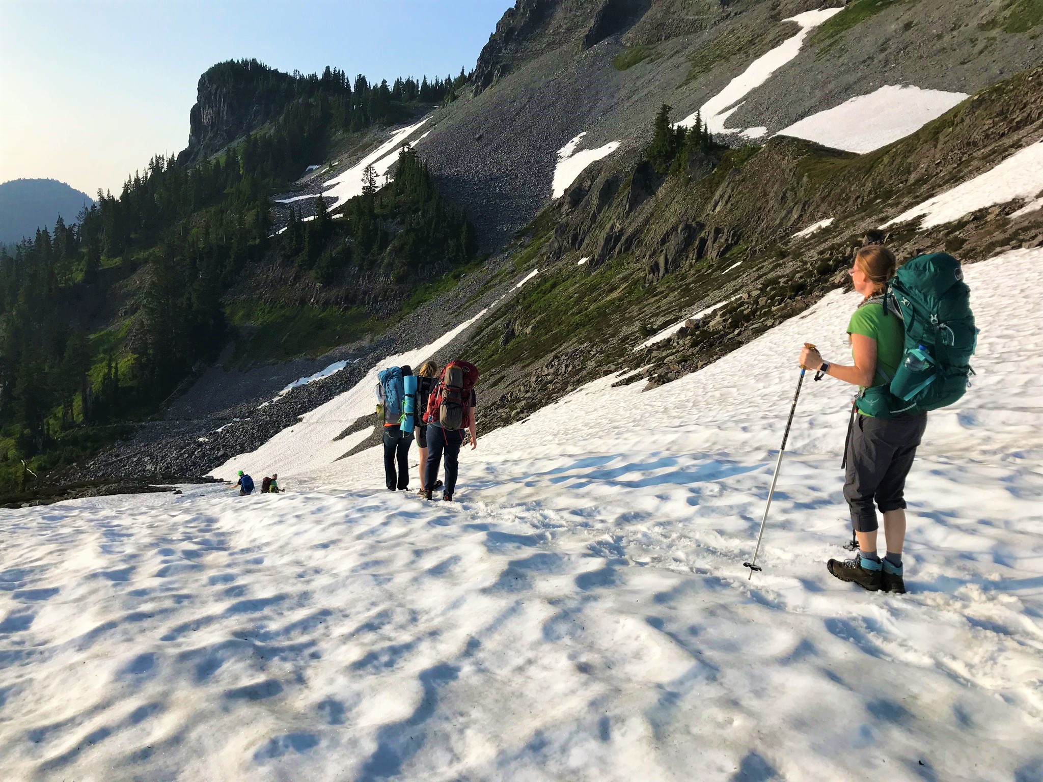
The trail traverses the slope for about 1.1 miles at which point crossing a saddle we began to drop down the other side of Table Mountain towards Mazama Lake. Despite it being late July and being at a relatively low altitude There was still snow covering the trail at the top of the saddle. I suppose this is a testament to the amount of snow this area receives during the winter.
As we arrived at Mazama lake we found that it was in fact mosquito season and saw fish rising in the small lake. Being that we arrived later in the evening than we hoped we were anxious to meet up with some friends that had come up earlier so we didn’t have time to stop and fish as we looked to see if they were camped out at that lake. Turns out they were not camped there and we needed to move on before we lost the light.
Most of our boys started backpacking around 11. For many years I was a scoutmaster in our local troop and every other summer we would do a week long backpacking trip in the North Cascades. In preparation for this we would begin doing shakedown trips starting in March. My oldest son was 11 turning 12 in July when we started his shakedown hikes and pretty scrawny. His pack was almost larger than he was.

While I still help out in scouts I’m not as involved as I was and despite continuing interest from the boys, which I’ll write about more in another post, the bi-annual backpacking trips have gone by the wayside. So Zach our youngest boy hasn’t yet really started to backpack, which I guess I didn’t fully realize until we were on this trip, and he just kept exclaiming how cool it was to be up there, how neat the views were, and of course asking when were we going to go backpacking again!
I must also admit though that the views on this hike are absolutely spectacular and while I like hard to get to obscure hikes without a lot of people, this one is definitely a must do.
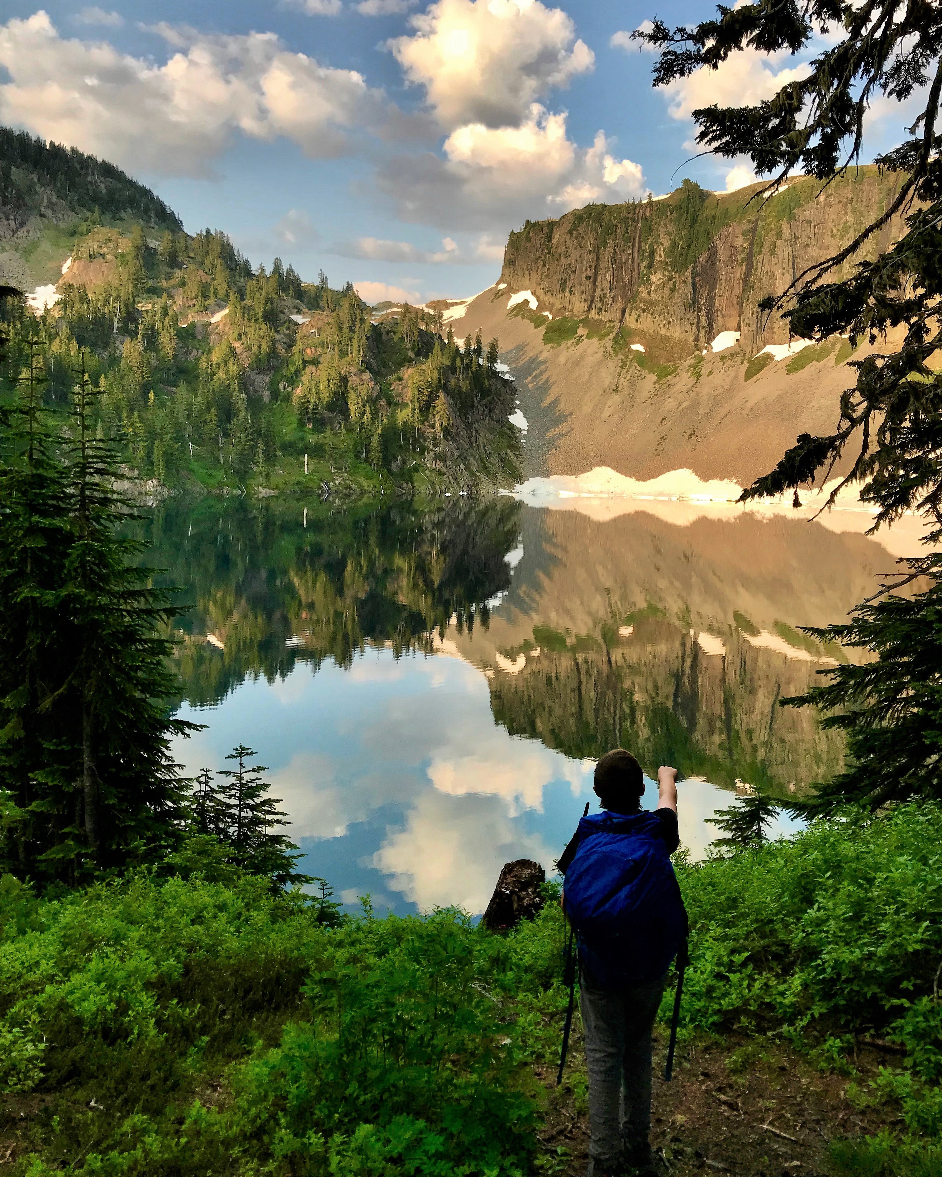
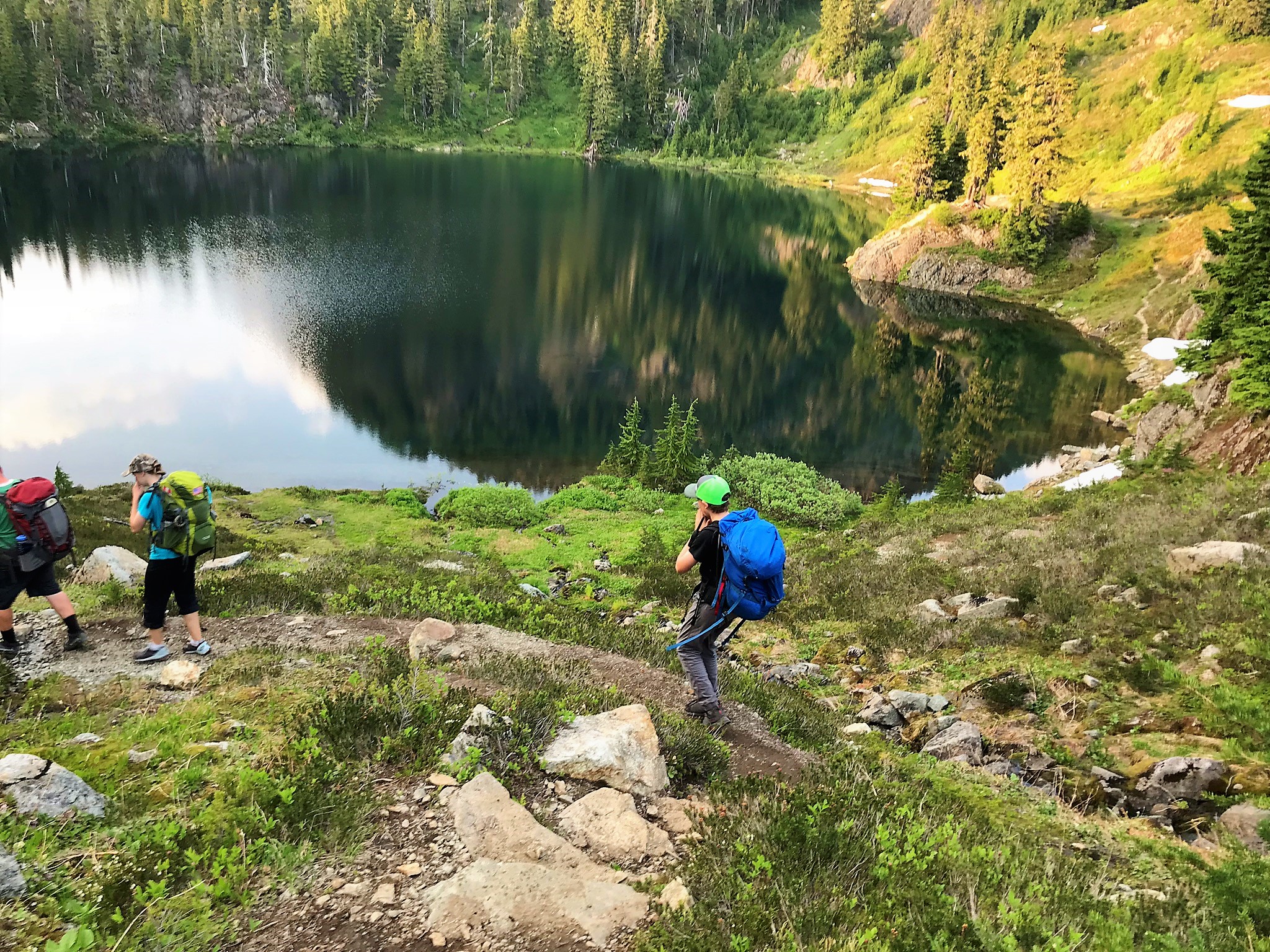
As we moved on from Mazama Lake we climbed up over a ridge to Iceburg Lake. Which is so named because…wait for it… it has iceburgs floating in it. I had read about this ahead of time and was a skeptic, but sure enough there were a few chunks of ice floating around in it. Not only were there chunks of ice floating around in it there were still significant snow fields at the bottom of the scree coming off of table mountain that extended into the lake, a sign of the amount of snow that must fall here during the winter storms.
As we came to the next set of campsites we met up with our friends, they had saved us some campsites and we set up for the night. The mosquitoes were out in force but the scenery was so gorgeous that it was easy to overlook them. The lake we were at was full of fish rising to the surface and colored with that wonderful blue green color of alpine lakes. Being late July it was a hot day and while it had cooled down some as the evening came on Charissa and Zach were itching to go for a swim in the lake. I being the wary traveler that from experience had found that most lakes that looked like this were also bone chillingly cold decided to forego the aquatics.
They found a rocky out cropping that they could jump from and jumped in. They reported that the water was a pleasant temperature and swam for a while, I enjoyed watching them and had I not been so tired would have joined in. Kassie, joined in with them, since she apparently didn’t bring a swim suit she just jumped in in her clothes. Sometimes it’s good to be young.
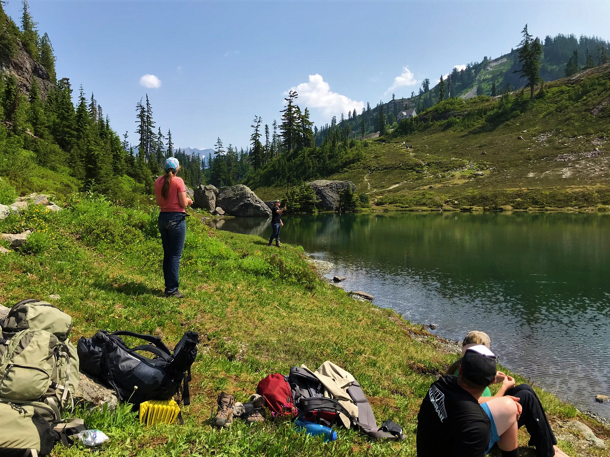
As we were heading back up to the campsite we passed Rachel who was headed down to the lake to fish. I had brought a couple of tenkara fly fishing rods and she was going to go down and try her hand at it. She was down there until it was too dark to see casting away.
The evening was warm, I had hoped we would see stars and that I would have the opportunity to do some night photography, in fact to that end I had hauled up my large digital camera, however we were unfortunate in 2 regards, first there was a layer of smoke that had moved in with the jet stream from forest fires in Siberia, apparently about 38,000 square miles of taiga forest had burnt and secondly as luck would have it it was the Super Moon. While we never saw the moon from our campsite due to the hill blocking it, it was quite a bright night.
First thing in the morning Rachel snuck down to the lake to fish. There was a squeal as she caught her first fish. Zach and I joined her shortly thereafter. It was a beautiful summer morning and in just an amazing setting, alpine lakes, blue skies, and green forests. We fished for a while with little success in the catching, as the fish were just beyond our reach, but well rewarded by the experience of being there.
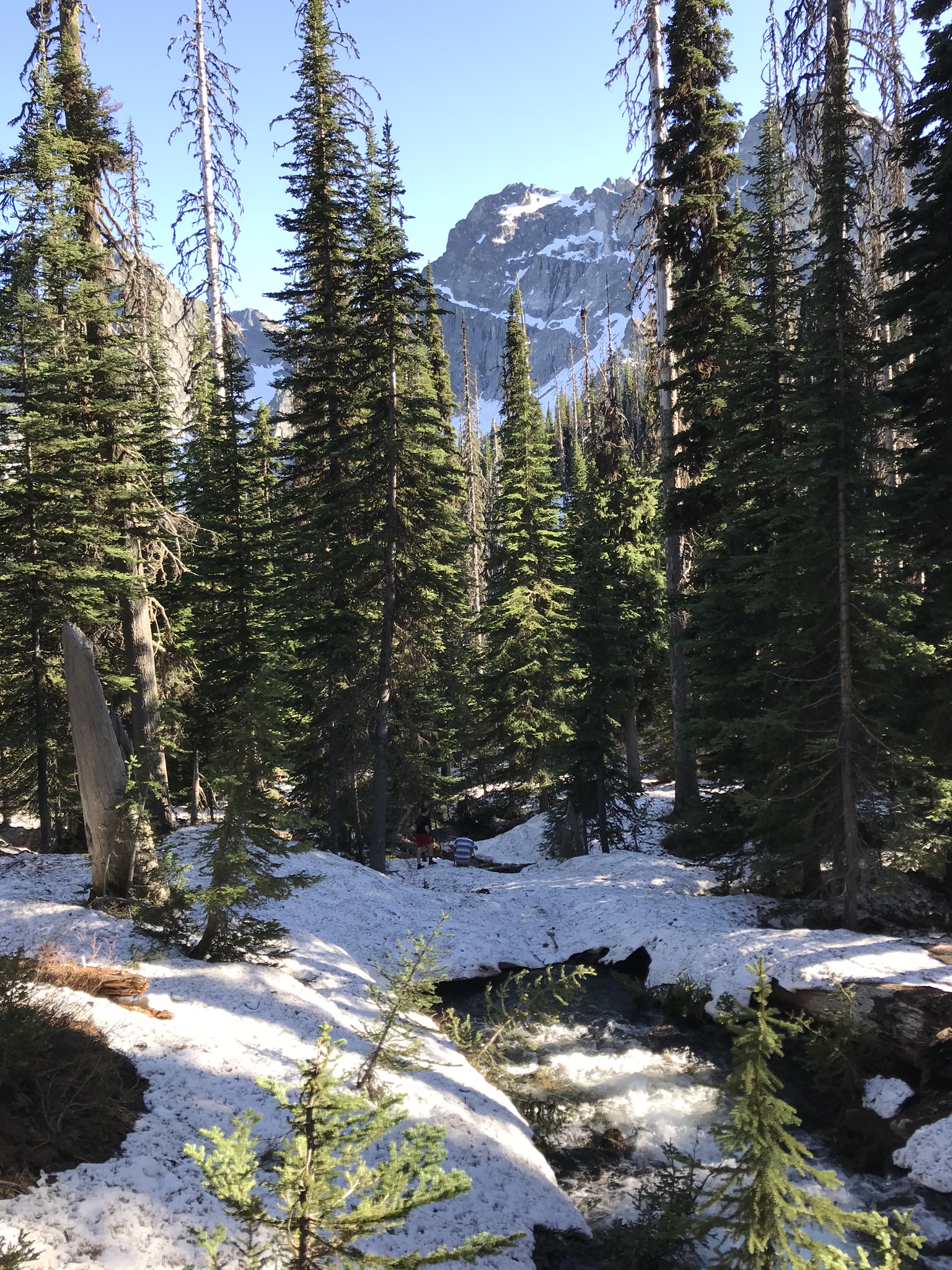
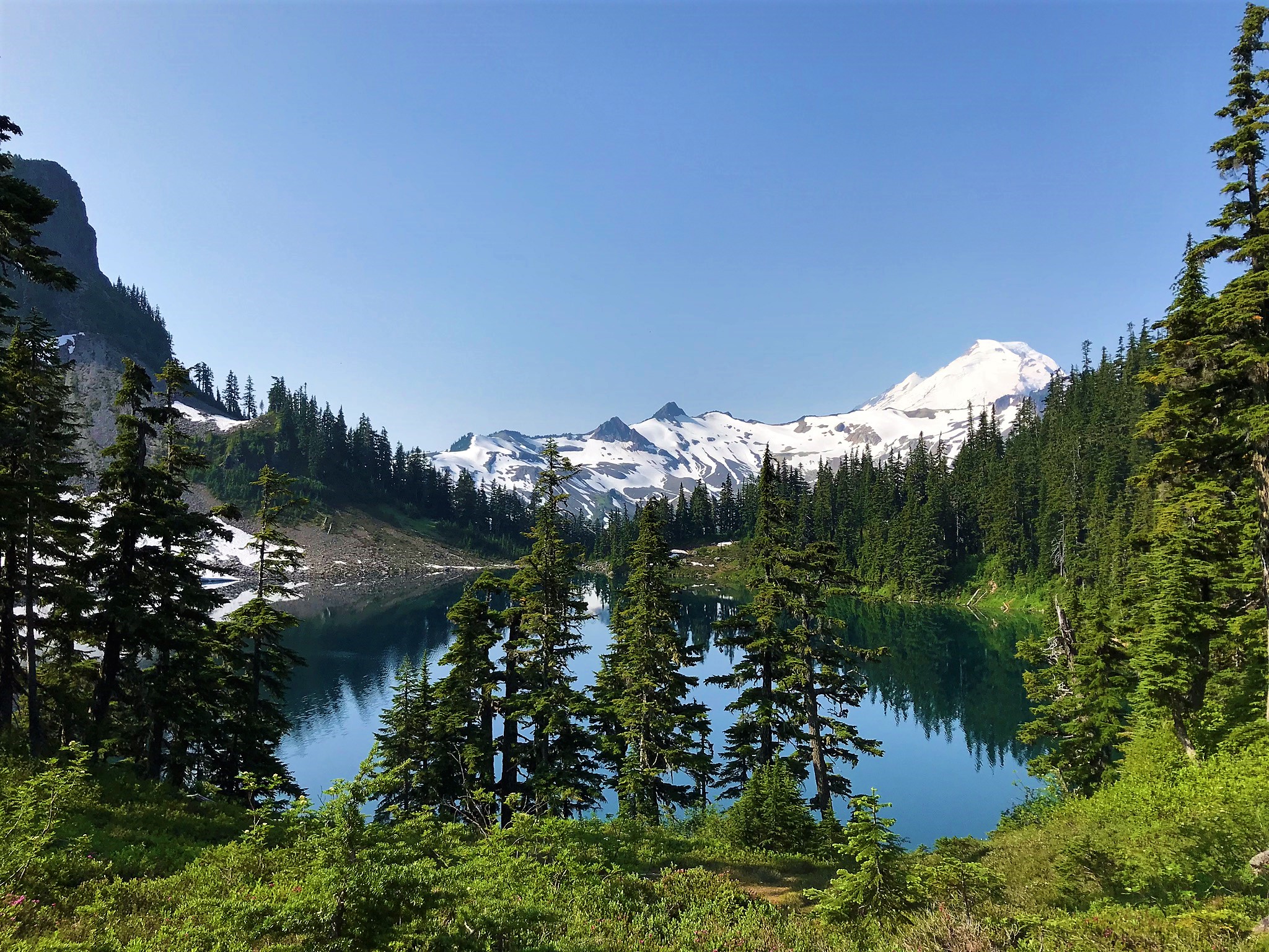
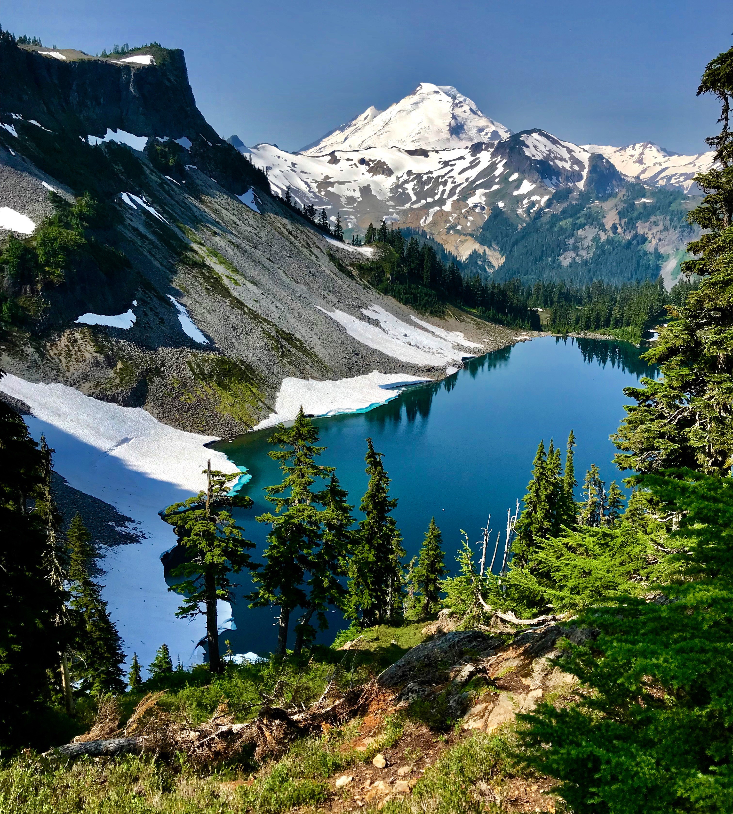
As we had some miles yet to put behind us we soon broke camp and moved on. Leaving the lakes we climbed to another pass above Iceberg lake with amazing views of the lake and Mt baker behind it. Again at the pass we encountered snow, deep snow, that made route finding difficult. As came over the top of the pass we did in fact loose the trail. We could see where the trail came up the valley below us and made a traverse across the snow field to where we could intersect it and continue on.
We continued on down the valley to Bagley Lake. This part seemed to take forever, of course it was all down hill and in the sun. By the time we got to Bagley lake we were hot and tired (at least my feet were from all the down hill pounding). Bagley lake looked inviting with its crystal clear waters and after Charissa and Zach had had such a good time swimming in the lake where we camped the night before I decided to jump in.
WOW it was cold! I am not sure I have ever swam in a lake that cold. The creeks we swim in on the Hidden Lakes hike are cold, but this was to a whole different level. I swam out maybe 50 feet or so and back and promptly got out. After warming up a little bit on the shore decided to give it a second go. It was so cold that it was literally painful everywhere that had been submerged.
From Bagley Lake it was about 1/4 mile up to the lower parking lot and then another 1000′ gain and one mile to the Artist Point parking lot. As we climbed back up the views of the basin below with Bagley lake below and a view of the trail we had just come down were stunning. At the top of the trail we were back on snow fields for the last 1/4 mile or so to the parking lot.
Beta
Artist Point is a well known and heavily used area. While we did not find there to be excessive people on the trail and at the lakes on Friday night there were signs that the trail (especially the loop) is well traveled. Saturday we did find a lot of people on the trail, especially as the day wore on. The bulk of those were near the parking areas at Bagley Lake and Artist Point, we did pass a few people that were hiking the same loop as a day hike.
This can be done as an easy overnighter by going in from Artist Point and back out the way you came. The views will still be spectacular you just won’t do as much vertical. This is a better option if you have knee or feet issues that are exacerbated by excessive downhill pounding.
If you are looking for a more strenuous uphill route i.e. as a mountaineering prep or otherwise you could start from Heather Meadows or Bagley lake and go up to the lakes.
We used Green Trails Map 13SX which is the large map for the Mt. Baker Area, Green Trails map 14 Mt. Shuksan also has the trail system on it.
The mileage breakdown is as follows for the route as we did it: 1.1 miles from the Artist Point parking lot to the saddle at Ptarmigan Ridge. 0 .8 miles from the saddle to Mazama Lake (where there are 4 campsites available), 0.4 miles from Mazama Lake to the Hayes Lake junction, we hiked maybe another 1/4 mile or less to our campsite at Hayes Lake. From the junction at Hayes Lake it is .9 miles to Hermann Saddle. From Hermann Saddle it is 1.8 miles down to the bridge at Bagley Lakes. The next part is not clear on the maps but I would say it is about 0.25 miles from the bridge to the Bagley Lakes parking area and then about a mile from the Bagley Lakes parking area to the Artist Point parking area. That makes for roughly 6.35 miles round trip. You can extend that by hiking around the lower Bagley Lakes section.