Thursday morning I was driving into work when a friend sent me a text inviting me to join him Friday on a hike up North Twin Sister and well obviously I said yes, otherwise I wouldn’t be writing this.
I had some familiarity with this mountain, I’ve read a little about it and know some guys that have been up there, but honestly I didn’t really know much. During the day Thursday I took a quick glance at the Mountaineer’s page on it and at Summit Post. My buddy said we’d leave early and be home mid afternoon, those sites put the vertical elevation gain at 5,400 ft. As I was reading the reviews I thought I read that it would take 5-7 hours…. Something wasn’t adding up but whatever, the forecast was good and I needed to pack, download maps, and get some food.
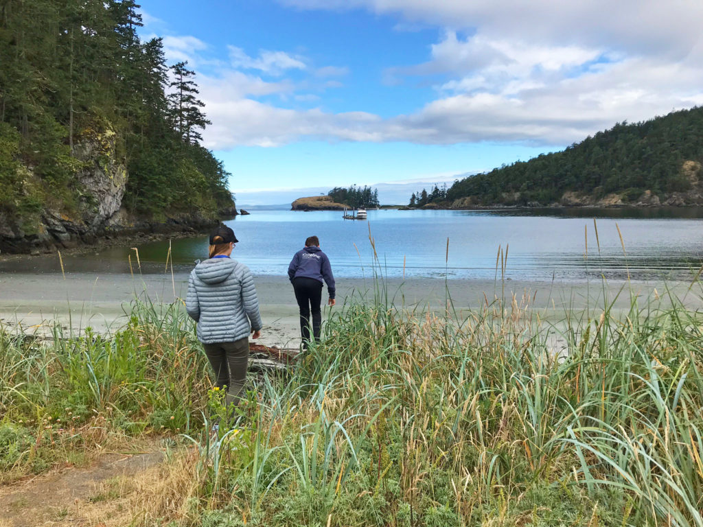
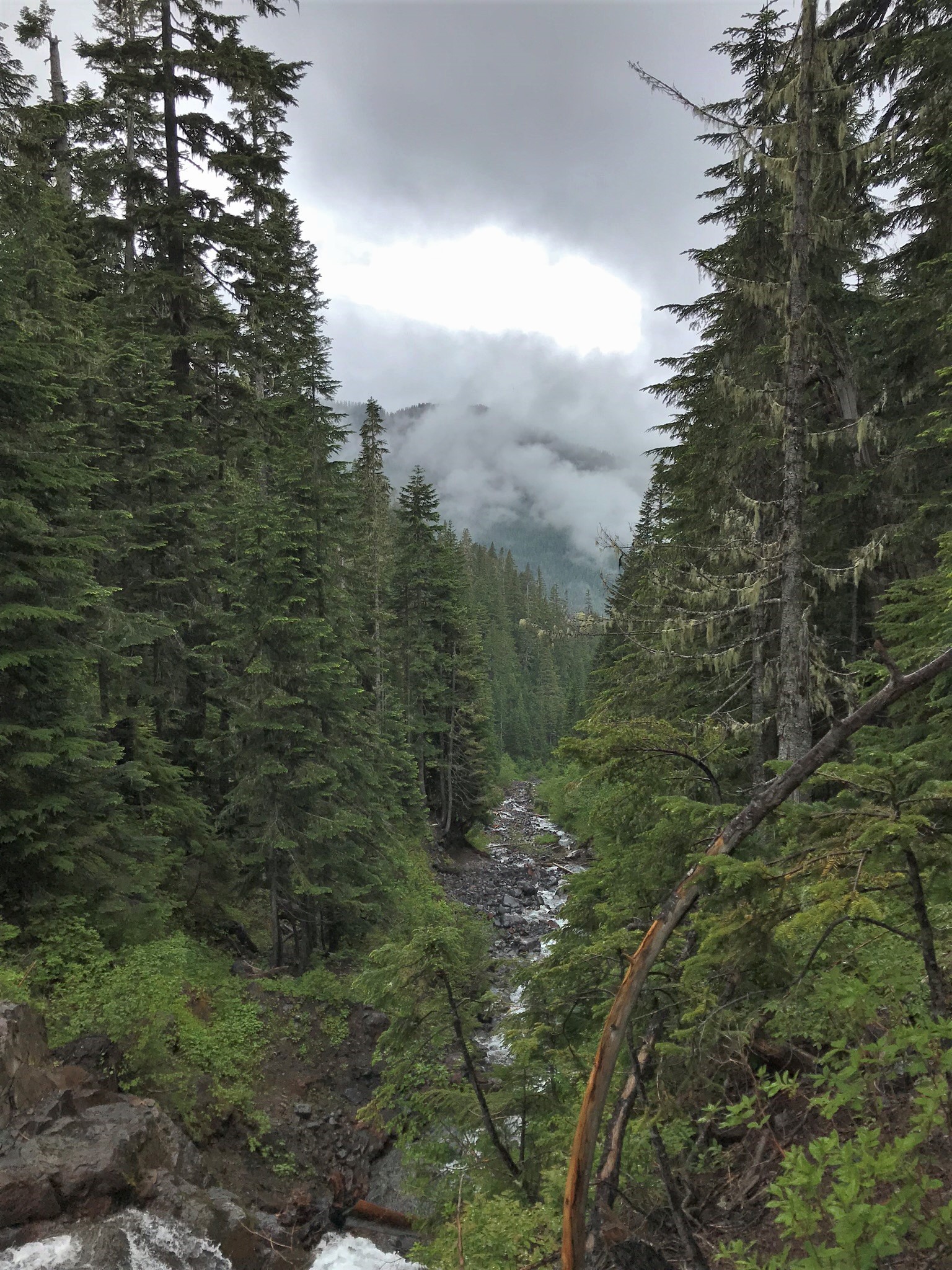
We got an early start and arrived at the gate around 7:30 am, just as it was starting to get light out. It was cold and frosty but clear with the intent to be a gorgeous blue bird day. This “hike” begins at the the middle fork of the Nooksack river, a boulder strewn river with fast running water.
Can you see me?
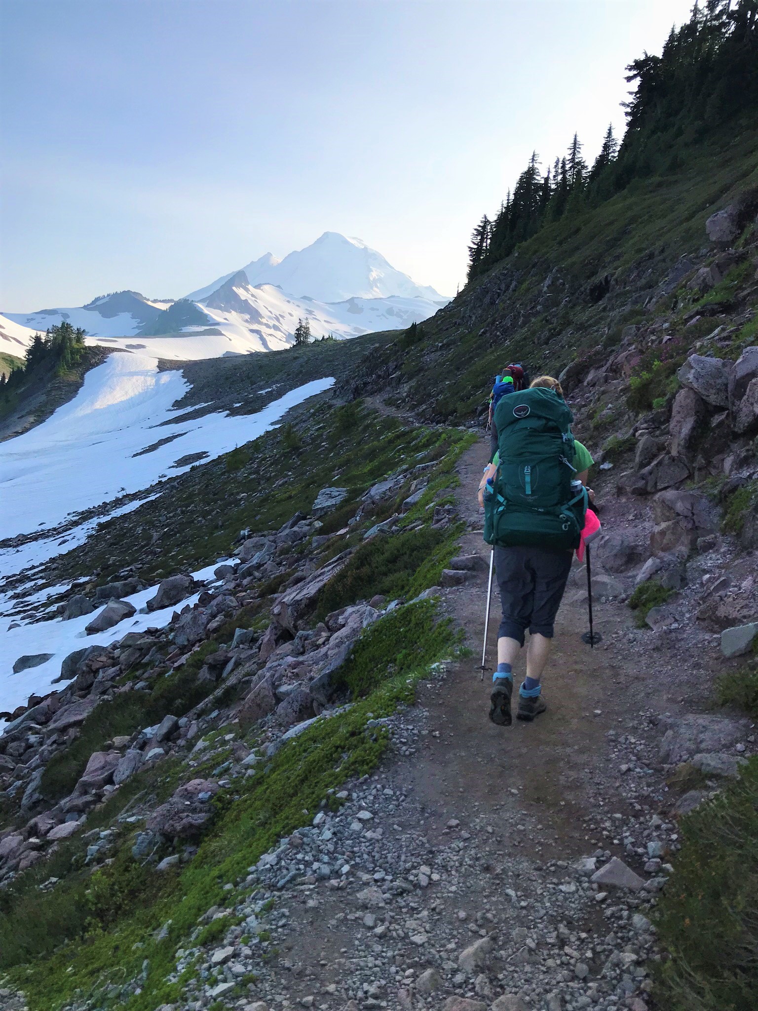
We slid our bicycles under the gate and began the 6 mile uphill slog. The first 4 or so miles was all on really well maintained logging roads and we alternated between riding our bikes and pushing them. I usually don’t mountain bike with a 20lb backpack so there was perhaps a little more pushing than riding. As we wound our way up we had amazing views of Mt. Baker and the Black Buttes. We could also see North Twin Sister as we climbed higher, an imposing pile of rock with a little snow on it and what appeared to be frozen waterfalls on its north side.
We pedaled and pushed on, riding across a sketchy frost covered bridge planked with 12″ wide boards that had a couple inch gap between them, soon after that branched off the road we were on to an abandoned logging road that is now mostly covered with young alders. This path seemed to go virtually straight up and we continued to push our bikes up it for nearly 2 miles. It unceremoniously ends at a small campsite that this particular morning was covered in frost and very well frozen with needle ice. We left the bikes there and started up on what was our best guess of the trail.
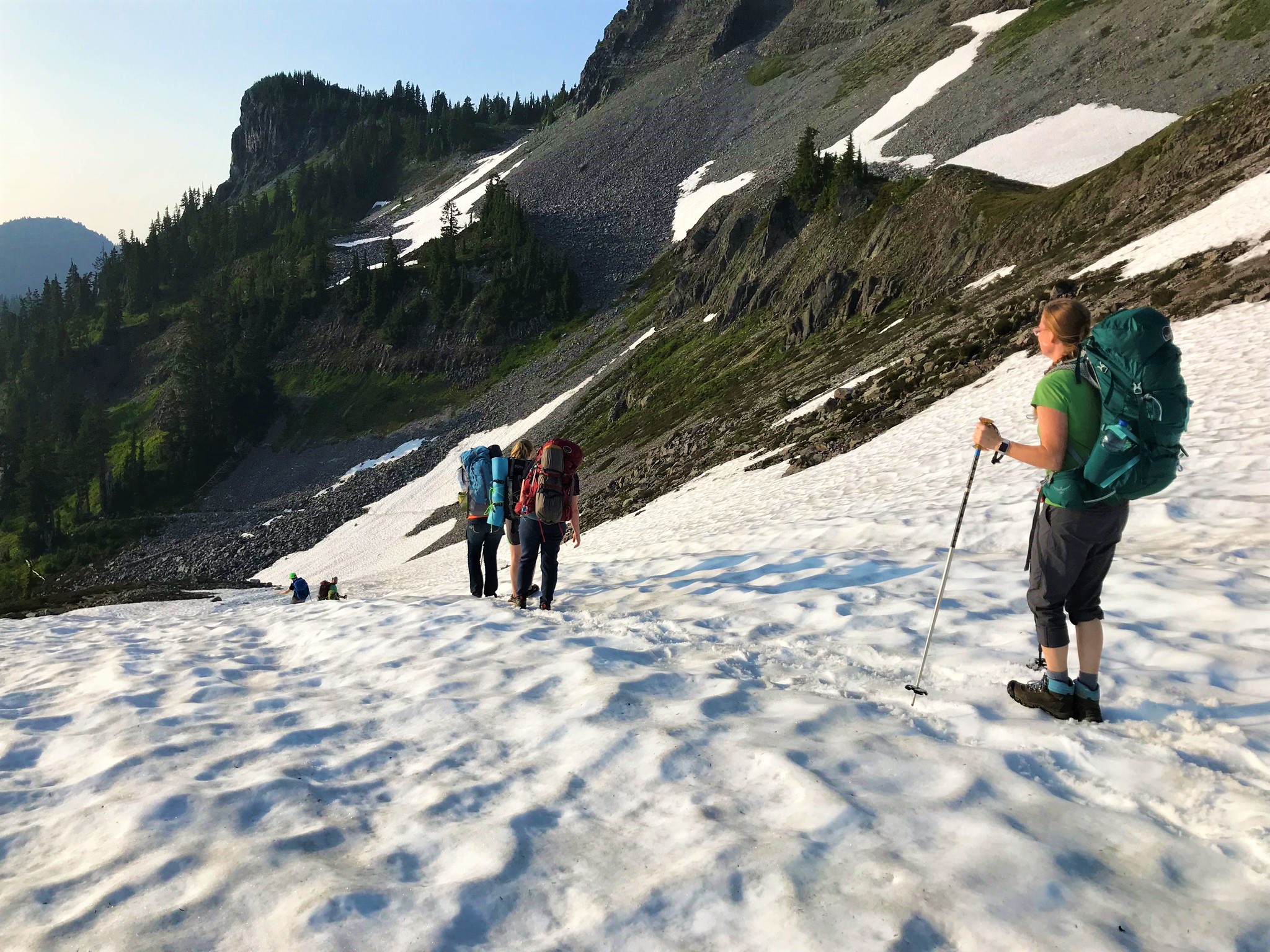
For the next bit we pushed our way through small trees and brush as we went up and up through the forest. The smaller trees and brush eventually gave way to a stand of larger trees and then we were out of that and onto the base of the ridge. The trail at this point had some leftover bits of snow here and there from the storms we had earlier in October and the trail was full of ice needles.
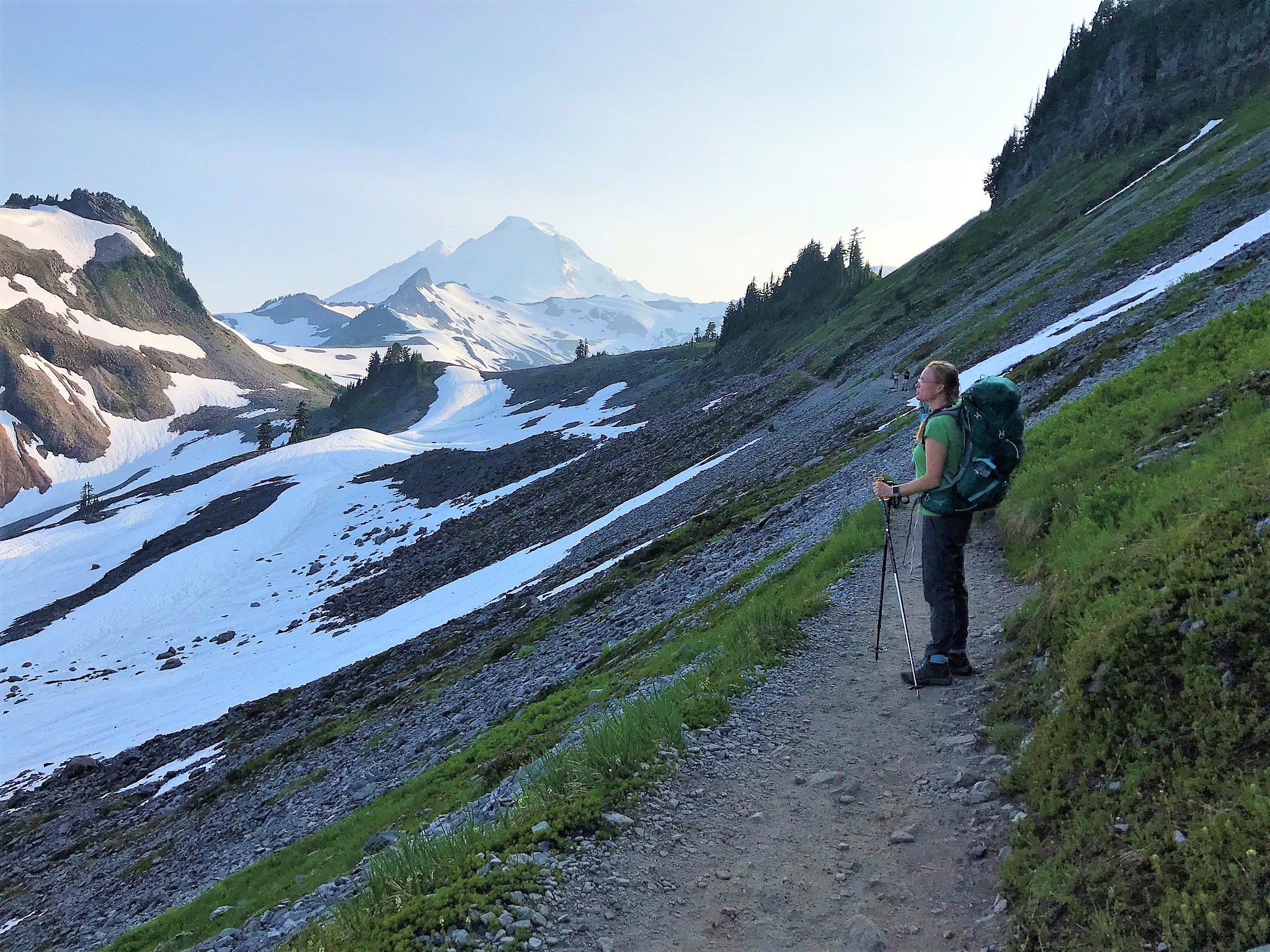
The trail wanders a bit but follows the ridge line among stunted conifers, which are a testament to the brutal conditions this area sees throughout the winter. With the smaller trees and the trail along the ridge line we can now see into the basins on the north side of the mountian and to the south we can see South Sister and the giant valley between the two. At one point as we paused to take a break Jason asked if that was the freeway we could hear down below us, after we hiked a little further the raging stream between the two mountains came into view and we realized it was the source of the noise we heard.
Soon this hike transforms into a 2000′ scramble. The good news is that the rock is a very grippy dunite and easily scaled. The bad news, the route is not always well marked.
In all honesty the scrambling part of this was really, really fun. A little sketchy in spots but the rock is really grippy and footholds and handholds were plentiful and good.
We continued to scramble our way up until we were at around 5,300′ in elevation. By this point we had been going for about three and a half hours, and had gained about 4,000 ft in elevation. We took a break in a nook on the side of the mountain and decided that it was time for us to head down.
We soaked in the view for a while and then began our descent. It was slow going down climbing the scramble but was wasn’t as intimidating as it seemed it would be. We took some time to take in the scenery, watching another pair of climbers advance up the ridge, some eagles soaring along looking for food, and a gyrfalcon.
We soon found out the reward for pedaling and pushing those bikes uphill earlier in the morning as we ripped down the mountain. That last 2 miles that had seemed so hard to push up was a hoot, every where the path crossed a stream there was a little jump (which is kind of awkward with a pack and an iceaxe on) but it was fun. The bridge that was frozen over in the morning was still frozen but we just blew right over it anyway and probably within 20 minutes of having reached the bikes we were back at the car, already thinking about the next trip up.
Yellow larches…..It seems like the rage is to go and see the yellow larches in the North Cascades when fall rolls around. For years now I have desired to get up in the hills in the fall and see what all they hype is about but autumn tends to get a bit crazy and usually before I know it the season has passed and I have not been able to get up there in time.
Some happy hikers
This year I made a mental commitment to myself to get up there before winter, but then of course came life. The first three weekends of September were spoken for by work. Then the house needed some attention, then we told one of the kids we would take him and his friends to Portland for the Retro Gaming Expo (not that that weekend would have mattered the weather was so bad and winterlike that Timberline opened for a day after the brunt of the storm and pictures from backcountry skiers looked like mid winter powder pillows). Finally though on October 26th we took the chance to get up in the mountains with the intent to hike from the Rainy Pass Trailhead on the PCT to Cutthroat Pass and back.
The North Cascades are often referred to as the American Alps.
We checked the weather almost religiously throughout the week and it said, sunny on the westside, sunny on the eastside. However we didn’t think to check it in the middle…. When we got up Saturday morning it was cloudy in Anacortes, which being so close to the water didn’t really mean anything and as we drove out of town the clouds went away and it was nice in the valley, but as we got closer to the mountains the clouds built back up and we noticed that there was fresh rain on the road in places. “Oh, well,” I thought after all we were headed towards the eastern end of the mountains and maybe we’ll get out of it. As we climbed from Colonial Creek it began to rain, then as we approached the magical white line on the trees above us the rain turned to snow, soon we didn’t even need our windshield wipers, and as we crested Rainy Pass there was snow sticking to the roadway. We turned left off of Highway 20 fishtailing our way onto a snow covered dirt road that led to the parking area for the PCT northbound.
Frosted hills in October
“Well,” I thought, “This isn’t quite what I expected.” Inside I wondered if we should press on or go find a lowland hike in Mazama. I really desired to hike up there, one to get some vertical in in preparation for backcountry skiing, and again I wanted to see some yellow larches. Charissa didn’t seemed phased about hiking in some snow and Zach was game too so off we went.
The trail starts at the base of Whistler Mountain and Cutthroat Peak and goes up the Porcupine Creek drainage to Cutthroat Pass. It begins in the forest at the parking lot and gradually works its way up hill, most of the trail is gently uphill with some flat areas, this is not a thigh burner hike but the good news is that when you turn around to come down it is and easy downhill, fast and not jarring.
Ice forming on the shrubs near a waterfall
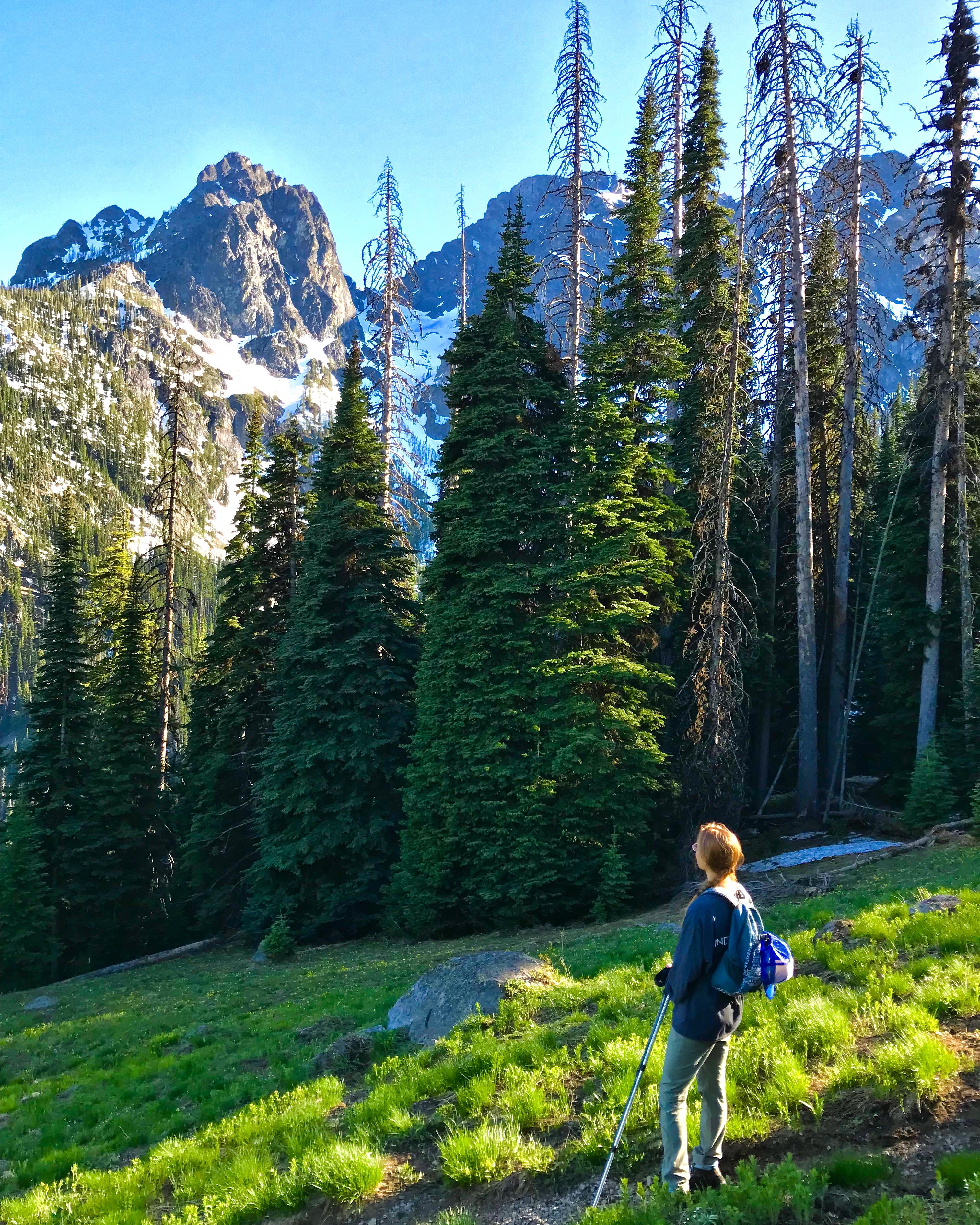
As we hiked up from the parking lot it continued to snow and while it did seem to be snowing steadily the clouds were light, thin, and quite dramatic. At points along the lower trail the forest would clear out for an slide path and we could see the mountains across the valley to the west of us, beautiful snow caped rocky peaks and fir forests.
Charissa on the trail enjoying the stunning views
At about 2 miles or so in we came to Porcupine Creek, a scenic creek bubbling and flowing its way down the mountain through the golden tan granite stones of the mountains. Spray from the creek had coated some of the branches next to it in ice, which seemed surreal to see in October and a testament to the prolonged cold temperatures at that elevation (around 5300′) already this year.
Stunning
After the creek there are large boulders scattered through the forest the size of a cottage. Zach and I wondered if it would be possible to carve homes or rooms out of them and how cool that would be (don’t worry we’re not going to do it), we assume that they fell there from the peaks just above us and to the west long, long ago. Massive chunks of granite dispersed through the forest.
As we worked our way up the west side of the drainage, gradually but continually climbing the forest began to thin and the views of Cutthroat Peak began to open up. Finally we could see some Larches a little further up and across the valley. To our left and uphill we could see up the avalanche chutes to the imposing granite peaks to the west northwest of us and to the south we could see into the Rainy Lake basin. Stunning spectacular views of forested mountains and rugged granite peaks cloaked in clouds and snow and ever changing as the winds whipped the clouds across the mountains.
The snow fall had ebbed somewhat by then and every once and a while we were warmed by sunshine peaking through the clouds. While there was snow on the trail in many spots by the time we hit 5800 feet or so it was completely snow covered, but packed and easy enough to travel. It really was a joy to enjoy the scenery around us and the scent of the forest.
As we got to the head of Porcupine Creek we came upon our first larch trees, unfortunately they were past their peak and somewhat more orange than yellow, but I was excited to finally get to seem some up close. We were really enjoying the hike and being a little late to see them at their prime just gave us incentive to plan for an earlier hike next year.
Ch
It was getting late in the day and we decided it was time for us to turnaround and head down the mountain. Some trails are so steep on the downhill that they are just brutal, this one is not. The down hill on this is so gentle that you can fly down it at a nice pace and not feel like you are getting the snot beat out of you. In fact if I had realized that on the way up (which I should have) we probably would have pushed on a little further). We flew down the hill stopping here and there to enjoy the view and some of the creek crossings.
It was a great hike and I was really glad that we were prepared enough to hike in the snow and that we pushed ahead and did it.
The drive home was almost just as scenic as the hike, Newhalem WA
If you don’t want to hear about the best hike in Washington State, don’t read this post. .
If the value of a view is measured by the sweat it took to get to it, this hike comes at a steep price and is still a bargain, am I over selling this? Based on my 2 hikes there no, I am not.
Just up the Cascade River from Marblemount this hike starts around 3,600 feet in elevation at the end of a steep gravel road that can look a little intimidating but was apparently doable by the guy in the dark blue Dodge Charger, which by the way I wouldn’t recommend, but kudos to that guy for sticking it out.
This hike is at a minimum from the trail head to the fire lookout 3,300ft of elevation gain in 3 or 4 miles, for those of us that are mathematically challenged that means it goes up pretty much relentlessly up for the first half of the hike. It starts in the forest meandering around through the trees as it climbs up the drainage for the East Fork Sibley Creek. After a while of wandering around in the trees you pop out into an avalanche scrubbed alpine valley and cross over the creek.
This is where the magic begins. Yes you are constantly going uphill, yes there is no shade and it can be swelteringly hot and humid from all the plants, but the view is AMAZING. Time it right and you’ll be wandering through acres and acres of wildflowers. Looking up you’ll see the granite peaks that you’ll soon be climbing up on top of. Looking down you’ll see the debris left from the winter snowstorms and avalanches.
default
As we neared the top of this wonderfully lush valley and began the transition into the alpine areas that were still covered largely with snow we saw a bear down below us across the valley just doing his thing a few hundred yards uphill of where we had just walked through. While not much more than a dot at this point it was neat to watch him meander through the mountain meadows. The last time we hiked through here we came on a mountain goat literally on the trail.
At about the half way point the trail begins to traverse south towards the peak with the fire lookout. The traverse is gently uphill (with a little down hill section that we didn’t notice until the hike down). At this point however we did begin to encounter snow fields. Which we expected and came prepared for with ice axes and crampons. We did not use the crampons, however if the snow had frozen over hard, like it was on our previous hike here, crampons or micro spikes would have been in useful.
From here we followed the boot pack and the trail when we could find it and worked our way up to the saddle between the peak with the lookout on it and the peak to the north.
Enjoying the view from the edge
Again this is a hike that doesn’t disappoint and as we continued to climb the views continued to amaze. The view down the Cascade River Valley continued to open up, snow capped mountians and deep mountain valleys surrounded us, and then as the lookout peak came into view it we were presented with an imposing granite peak rising up above us.
Lunch Break
At the saddle between the peak with the lookout to the south and Hidden Lake Peak to the north you’ll get your first look at Hidden Lake which is about 1000′ below the saddle to the east with a backdrop of verdant valleys and snow capped peaks. Early in the summer the lake is still covered in snow and ice. The trail to the fire lookout takes off from the saddle and virtually strait up the peak, look for the cairns and you’ll be OK.
Time Lapse over the mountians
I am always amazed at these fire lookouts about the men that had to haul the stuff up to these remote peaks to build, maintain, and live in them. We spent some time hanging out and enjoying the view from the top and then decided to go back up the ridge to Hidden Lake Peak. Just below the peak and above the saddle there is a flat spot on the ridge of giant granite slabs and plenty of places to get some cool pictures overlooking the lake. Zach and I hung out there while our hiking buddies went the rest of the way up to the peak.
The way down was a blast, being that probably for the top 1,000′ or so we were in the snow and were able to glissade down.
Once we were out of the snow though it was a bit of a slog through the alpine meadow as things had began to warm up and it was pretty muggy, as remarkable consolation though the alpine flowers were out and the views were amazing.
Finishing up the hike I stopped at the creek just before the parking lot and tried out the new water filter I had just purchased to get my self some ice cold water for the ride home. It was very refreshing!
Spring in the Pacific Northwest is this thing that often sneaks up out of the end of winter. It will have been dark, cold, and miserable for months and then suddenly the sun is warm, the daylight hours are longer, and flowers begin to come forth. It also stirs the soul to be outside and wander through the woods. Yet winter still has her grip on the alpine hikes, coating them in a beautiful vestment of snow and ice.
Yet never fear the great thing about the PNW is that there are plenty of hiking opportunities that are just as scenic yet don’t require the equipment or skills that snow travel demands.
Here are a few of the ones that we have done:
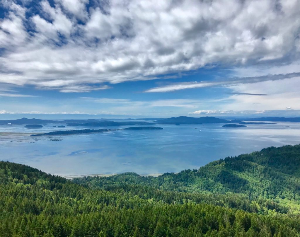
Oyster Dome – Between Mt. Vernon and Bellingham this popular hike ends in spectacular views over the San Juan Islands. You can start from Chuckanut Hwy if you want to pack in the vertical feet or from Blanchard Mountain Parking areas for those inclined to do less vert. Lizard and Lily Lakes have camp areas making this a great early season backpacking area too.
View from Oyster Dome
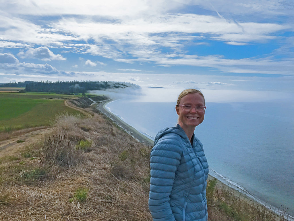
Fort Ebey/Fort Casey State Parks on Whidbey Island – Here you have your option of a forest hike or coastal views, or both. At Fort Ebey there is the Kettles trail system that meanders through the woods, providing miles of trails in the coastal forest, then if you want views you can hike along the beach and high bank ridges from Fort Ebey south to Fort Casey. The views here over the Strait of Juan de Fuca are truly stunning. There is hike in only camping available at Fort Ebey which while maybe not as rustic as backpacking in the mountains does make it a convenient early season backpacking trip.
Hiking along the coastline of Whidbey Island between Fort Casey and Fort Ebey
Rosario Head to Lighthouse Point – This gem is tucked away in Deception Pass State Park. The views are amazing and the terrain is varied enough to keep it fun for the whole family. One way to do this is to start at Rosario Head, hike south to Bowman Bay and continue south following the signs to Light House Point, which will take you across a tombolo and then the trail loops around the head. Alternatively you could start at Bowman Bay if time is an issue. You’ll enjoy stunning views of the Strait of Juan de Fuca, the San Juan Islands, Deception Pass, and coast forest trails.
Hiking out on the tombolo at Bowman Bay
Whistle Lake – Located in the Anacortes Forest Lands this area is popular with swimmers in the summer time when the lake warms up enough to actually be enjoyable. In the spring it is a great hike through the forest with lake views that some times include otters and eagles. It can be a short 1.75 mile out and back to the lake or about a 5 mile round trip to go all around the lake with options in between that make it a great hike that can be tailored to your time and needs.
Whistle Lake in the Anacortes Community Forest Lands
Heart Lake – Also located in the Anacortes Forest Lands is Heart Lake. Parking is at the lake and the trail around the lake is about 3 miles. This trail is pretty flat but the views are great and even if the weather is otherwise blustery it can still be pleasant in the forest. Sometimes we will do this as an out and back going part way around the lake and then returning or as a loop. When we do it as a loop I prefer to cross Heart Lake Rd and hike back on the trails on the otherside of the road instead of hiking along the road as the shoulders of the road are narrow to non-existent. An alternative strategy could be to drop a 2nd car at the parking area at the bottom of Mt. Erie.
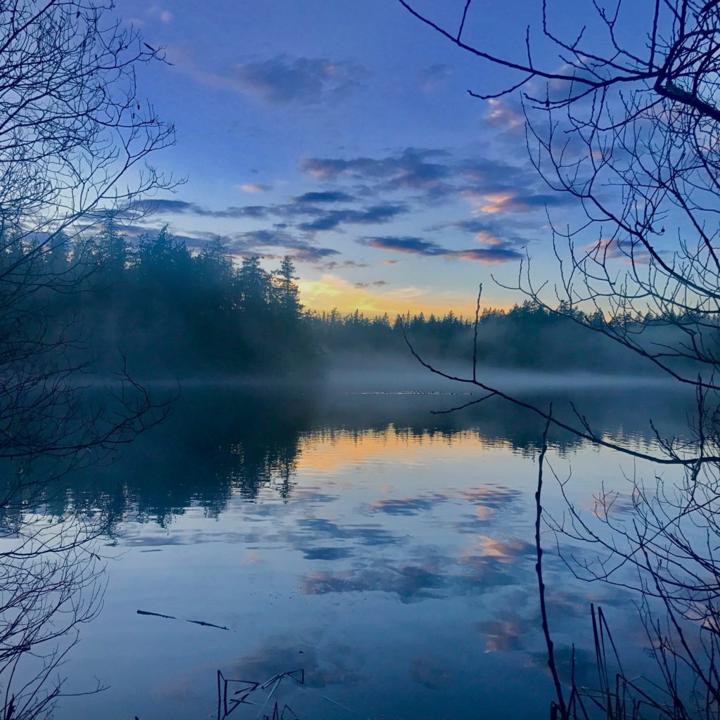
Winter Sunrise over Heart Lake
Sugar Loaf Mountain – This hike is one of my go to hikes for mountaineering preparation. It is a little less than a mile from the parking area at the bottom of Mt. Erie to the top of Sugarloaf and gains about 600 vertical feet, considering that the first 400 yards is flat, it is a pretty steep hike. The hike takes you through the forest with a couple peeks here and there of the islands until the very end where you are rewarded with stunning views of the Strait of Juan de Fuca, Whidbey Island, and the San Juan Islands. You can go back the way you came or pick from one of the other trails to take a different way back. If you are not familiar with the AFCL Trails make sure you have a map or gps with the trails on it, they can get quite confusing.
Summer in the Pacific Northwest is supposed to be that brief time between spring and fall that the sun shines and the rain stays away. Northwest summers are a special season that make people from out of the area fall in love with the beauty of the area and keep those that are live here from leaving, we have had some amazing summers in the last few years, but the weather does remain capricious, always willing to throw in a surprise here or there or have its own way at will.
PNW
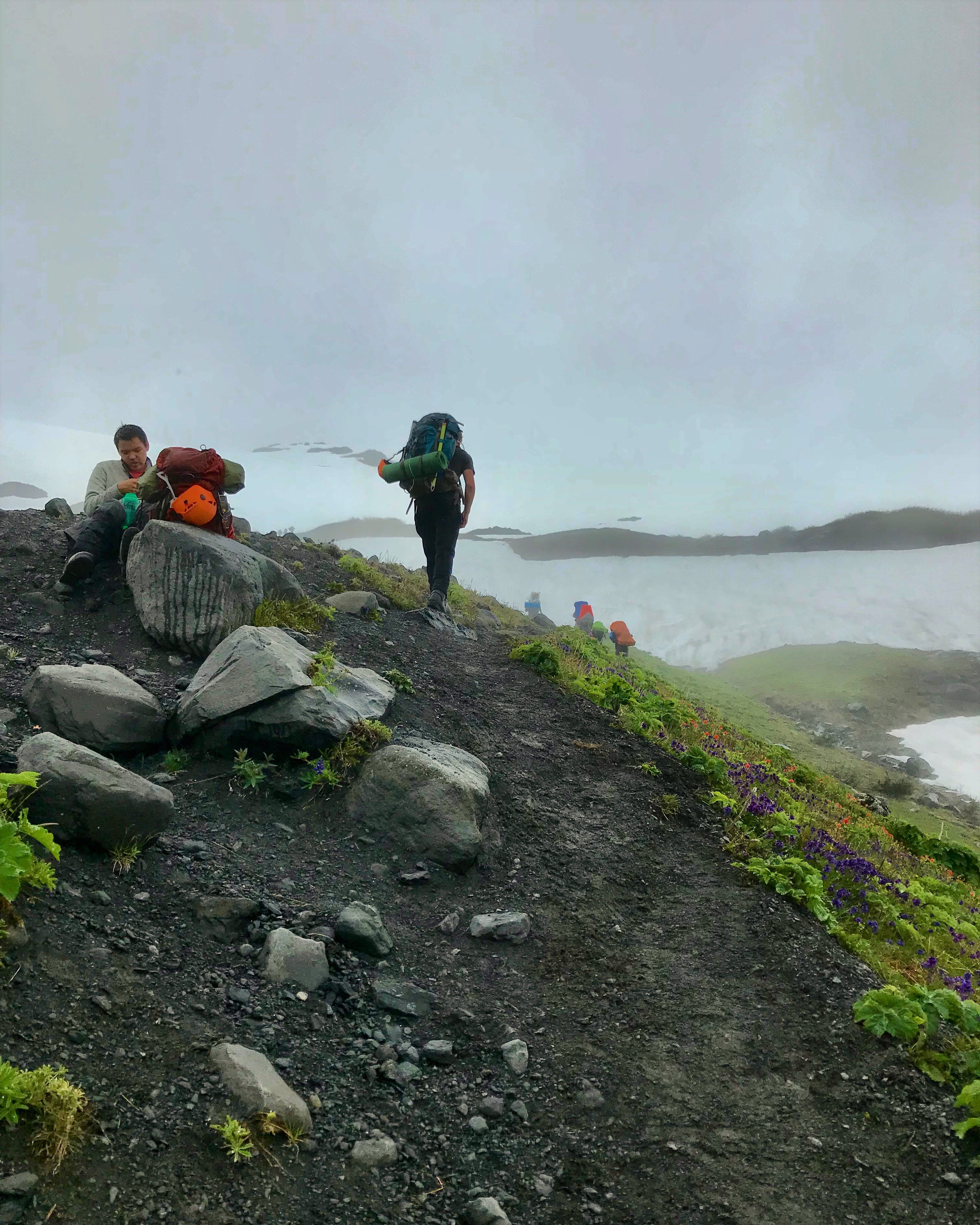
I for better or worse have been organizing groups to go mountaineering for the last 4 or 5 years. Typically these have been Boy Scout groups for young men 16 and up. We usually try to have the activity, especially if it is mountaineering selected by January so that we can start our training in the winter and be prepared by early summer for the activity, because another activity was selected I figured climbing wasn’t going to happen. However in early April I felt impressed to put together a Mt. Baker climb. I talked with some of the boys that had done previous climbs with me and they were good to go, then I spoke with some of the other adults that I had climbed with in the past and most of them were in and wanted to bring family members.
Trudging up to Hogsback Camp
Most people do Mt. Baker as a 2 day climb, which was our plan, we would head up to base camp at the hogsback at Heliotrope Ridge then do an alpine start for a summit attempt early Saturday morning, after reaching the summit we would return to camp, take a nap, and then head home. The dates we selected were for June 29th and 30th, generally a good bet that the weather will be fair.
Well it wasn’t. I don’t really know much about weather in other parts of the country but here sometimes when we have an event coming up on a certain date we’ll start printing out weather forecasts 2 weeks in advance so we can see how the forecast changes from day to day. Quite often the forecast for 2 days out even isn’t accurate. The weather forecast had been shifting around for our climb and in the end unfortunately the forecast was accurate, it just wasn’t in our favor.
Meeting that morning under a deck of grey clouds we decided to head up and take a look anyway. For some it was the only weekend they had available to climb and since they had already taken the time off work wanted to go anyway. I had been up a month earlier to the hogsback and while the weather wasn’t great down at sea level on that day, it was OK up on the mountain.
When we arrived at the Heliotrope Ridge trailhead it had not yet began to rain but the skies were solid cloud. While we finished packing up and getting on the trail a few sprinkles began to fall.
The hike through the woods was great, despite the weather spirits were high and the conversation was enjoyable.
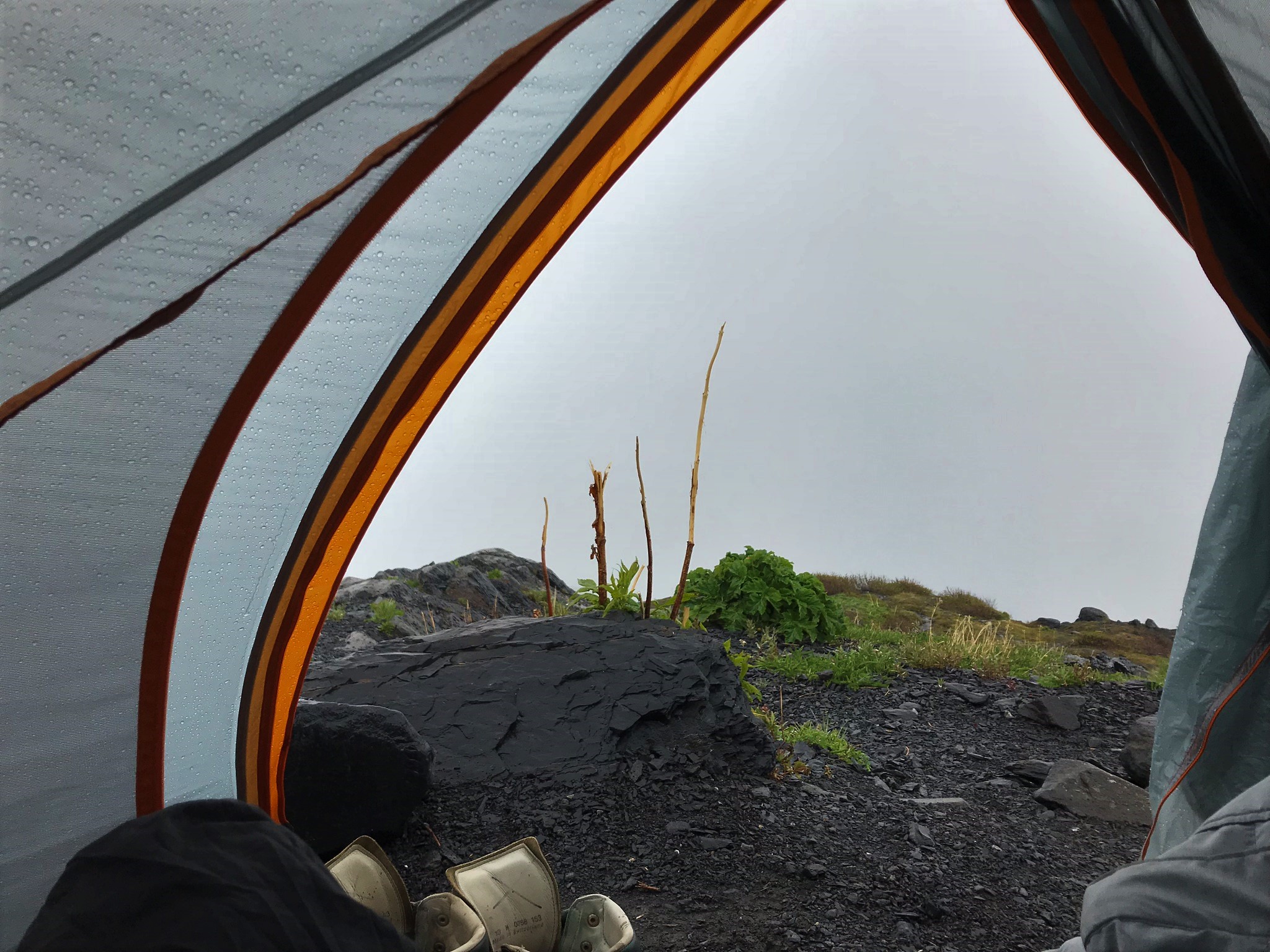
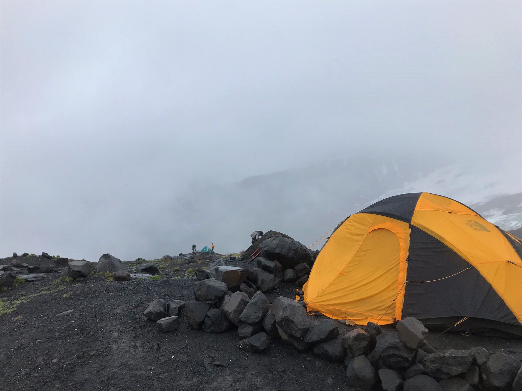
When we arrived at the Hogsback we quickly set up camp and no sooner than we had our tents up it began to rain quite hard. As seems to be typical for me, I had been busy coming up to this activity and was kind of tuckered out to begin with so on one hand have the respite of the rain to trap us in the tent for a little bit and get a nap was nice, on the other hand we needed to be up doing some training with the new guys and preparing our gear for the climb.
The glacier over there is quite impressive as you can see….when it’s not socked in
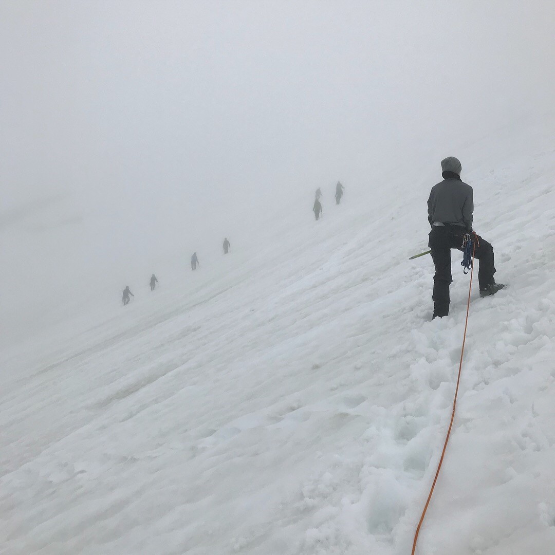
So while we ducked into our tents to get out of the pouring rain, my hope at this point was that the rain would back off in an hour or so and that we could continue making our preparations. It soon became apparent however that the weather was not going to improve significantly. So after a couple of hours of hiding out in the tent I got up. The rain had backed off to the point of not being a torrential downpour, but the clouds kept rolling in and out, sometimes we were in the clouds and sometimes we were just below the cloud deck, but never could we see the top of the mountain and usually we could not see the top of the glacial headwall in front of us.
When I got up I found that everybody was happily tucked away in their tents, unfortunately they were all spread out. We began to discuss our options and whether or not we should press on. Some were keen to keep going for the summit but the conversation always turned to putting the final decision on me. Knowing from experience that the chances of us being able to return and try again were slim due to the busy nature of summer schedules I felt quite a bit of pressure to not call off the climb if at all possible.
For quite a while I contemplated the current weather, looked at the hourly forecasts, considered the hazards we might face on the mountain, and took into account the responsibility I had to bring at least the youth involved in the trip home in more or less one piece.
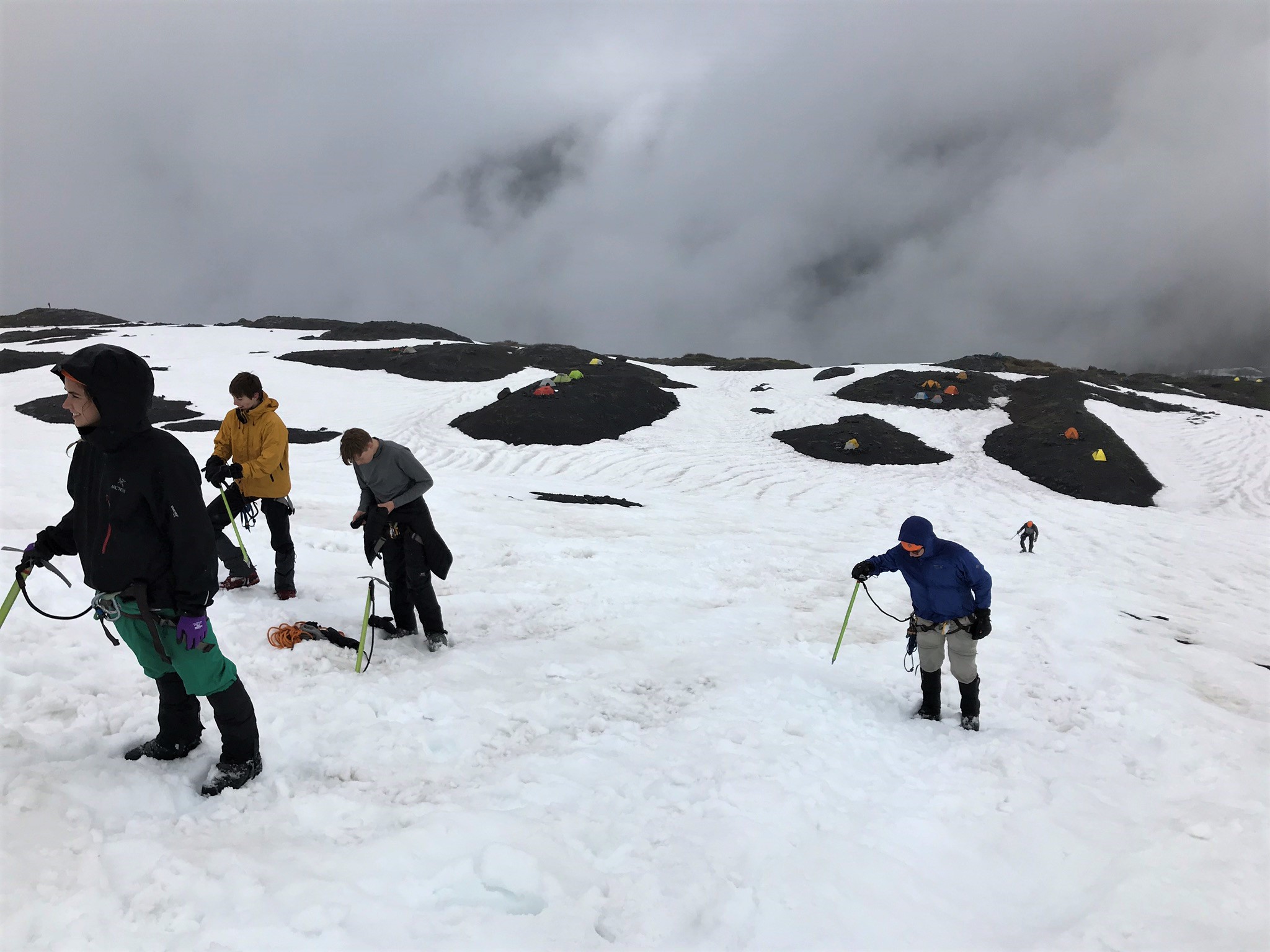
Ice axe and glacier travel training
After really sitting down and looking through the weather forecast which showed periods of heavy rain below 8,000 ft and snow above 8,000 ft, polling the group to find out who was proficient with compass/gps navigation in a white out, and considering that we would most likely at a minimum be wet and miserable as well as suffering through minimal visibility, while traveling on a glacier full of crevasses, it was decided that the prudent thing to do was to call off the summit attempt.
Only slightly humid
This was a difficult decision to make, as I mentioned historically getting a second shot at it has proven to be almost impossible as people’s summer schedules are usually booked full. Northwest weather tends to be unpredictable, which also means that we could have left in a rainstorm just to see sunny weather the next day, but sometimes, and especially in mountaineering you have to make a hard decision and live by it. In this case with all of the factors weighed, level of preparedness, level of experience, current weather, weather forecast, known route conditions, and even the pleasure factor, not going was the right decision even though it was the tough one to make.
Suddenly everything looks white
We had planned on doing some on snow training earlier that afternoon that had been put off due to the rain. As the rain had lifted to just a few sprinkles by the time the decision to call off the summit attempt was made we decided to go ahead and do that so that we would be more prepared should we be able to put together a second attempt. We got everybody roused out of their comfortable sleeping bags and up on the foot of the glacier and spent an hour or so practicing being roped in, self arrests, and crevasse rescue techniques. During this time the clouds continued to move in and out at times we couldn’t even see camp just a few hundred feet below us. This really helped some of the people that maybe weren’t so sure about calling it off realize that it was a good call.
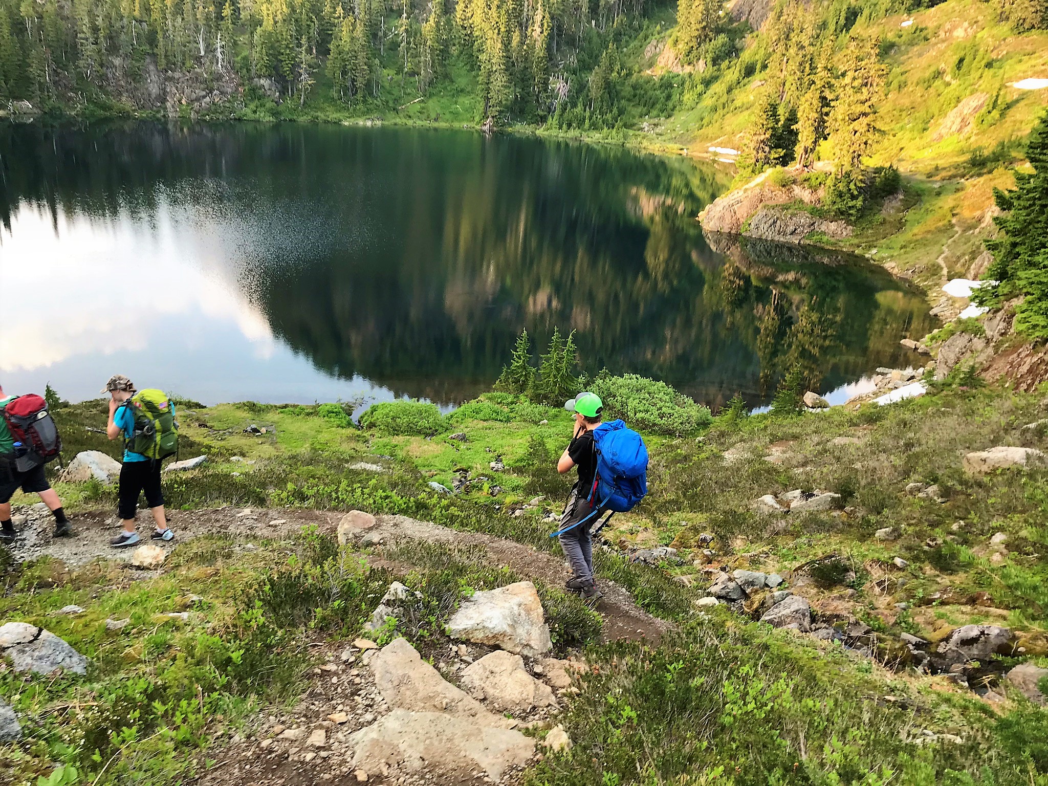
Zach’s First Backpacking Trip at an Amazing Hiking Route Located Nearby.
As you may be aware this summer Charissa and I volunteered to take a group of young women on a 4 day backpacking trip. As part of the preparation for this trip we did a series of overnight trips that increased in difficulty as we prepared for the longer trip. After the 2nd overnighter we asked if any of the girls had a hike they would like to do and one of them said that they had done a route called Chain Lakes near Mt Baker and would really like to do it again.
I looked it up and it had good reviews, although it was a little shorter than what I had hoped we would do on this hike, the last before the 4 day hike, we decided to go ahead and do it anyway.
Mt Baker via Ptarmigan Ridge
In researching the hike the reviews I read pointed out that it is a well traveled area and a popular hike, because of that camping is only allowed in designated areas. After the previous hike to Lizard and Lily Lakes where we almost didn’t get a campsite this had me a bit worried but luckily one of the fathers in our group volunteered to head up early with his daughter and secure campsites for us.
We chose to start at the parking lot for Artist Point. For those of you that aren’t familiar with this area this is the same area as the Mt. Baker ski area, from Bellingham you drive out about an hour to the end of highway 542.
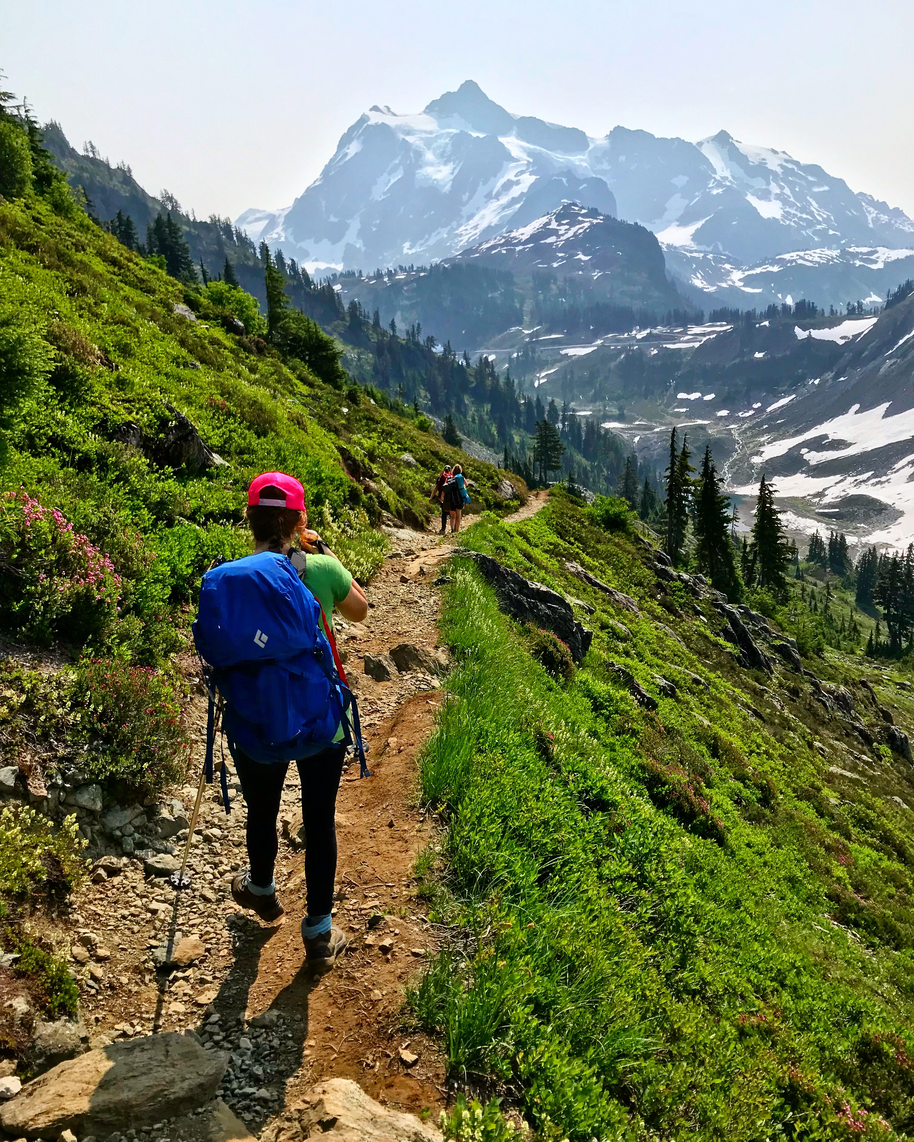
Mt. Baker ski area is not really on Mt. Baker but is located between Mt Baker and Mt. Shuksan. Mt Shuksan is a beautifully rugged peak with a glacier and ice falls that captivate the attention and overlook the ski area.
The trail starts at the southwest corner of the parking lot and traverses the slope from the top of Table Mountain that falls into the Swift creek drainage.
Mt Baker via Ptarmigan Ridge
Almost immediately after leaving the parking lot we were treated to amazing views. This trail follows Ptarmigan Ridge onto Mt Baker and you can see right up onto the mountain. Looking to the left down the creek you can see Baker Lake, around 4,000 feet below the trail and about 8 miles away. The scale is stunning.
The trail traverses the slope for about 1.1 miles at which point crossing a saddle we began to drop down the other side of Table Mountain towards Mazama Lake. Despite it being late July and being at a relatively low altitude There was still snow covering the trail at the top of the saddle. I suppose this is a testament to the amount of snow this area receives during the winter.
Crossing the saddle to drop down to Mazama Lake. It’s late July and still a ton of snow!
As we arrived at Mazama lake we found that it was in fact mosquito season and saw fish rising in the small lake. Being that we arrived later in the evening than we hoped we were anxious to meet up with some friends that had come up earlier so we didn’t have time to stop and fish as we looked to see if they were camped out at that lake. Turns out they were not camped there and we needed to move on before we lost the light.
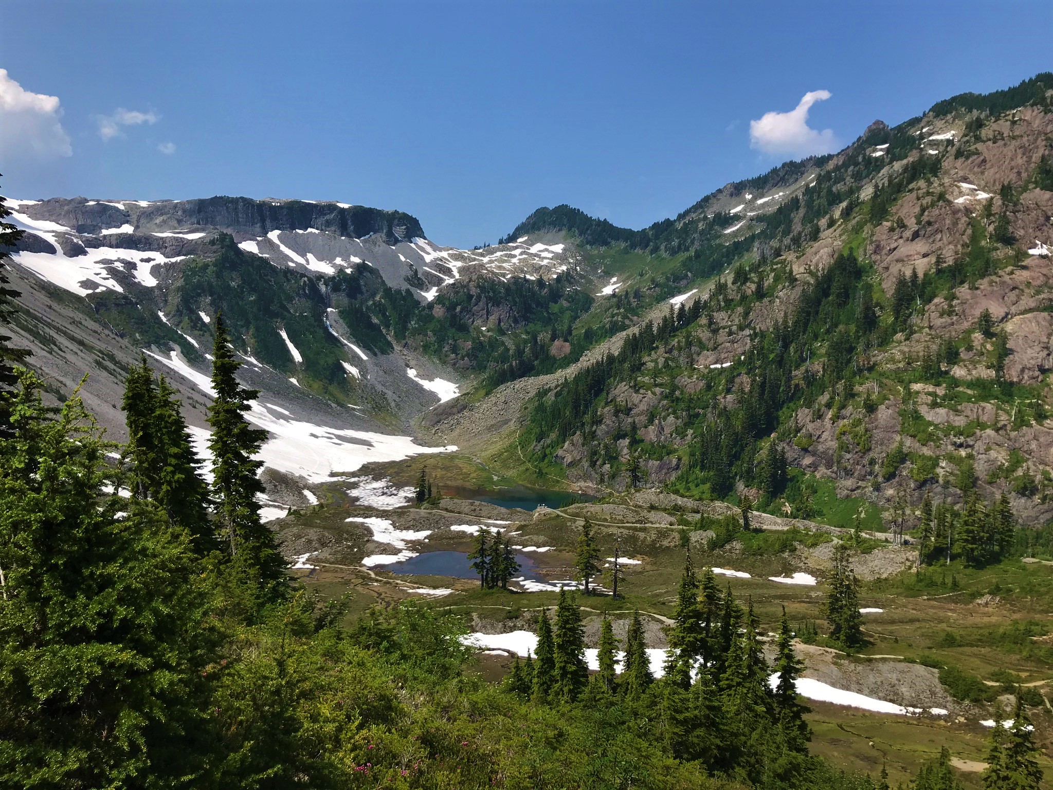
Iceberg Lake and Table Mountain, little did we know that we would cross over the notch to the left of the mountain the next day.
Most of our boys started backpacking around 11. For many years I was a scoutmaster in our local troop and every other summer we would do a week long backpacking trip in the North Cascades. In preparation for this we would begin doing shakedown trips starting in March. My oldest son was 11 turning 12 in July when we started his shakedown hikes and pretty scrawny. His pack was almost larger than he was.
Alpine ink blot
While I still help out in scouts I’m not as involved as I was and despite continuing interest from the boys, which I’ll write about more in another post, the bi-annual backpacking trips have gone by the wayside. So Zach our youngest boy hasn’t yet really started to backpack, which I guess I didn’t fully realize until we were on this trip, and he just kept exclaiming how cool it was to be up there, how neat the views were, and of course asking when were we going to go backpacking again!
I must also admit though that the views on this hike are absolutely spectacular and while I like hard to get to obscure hikes without a lot of people, this one is definitely a must do.
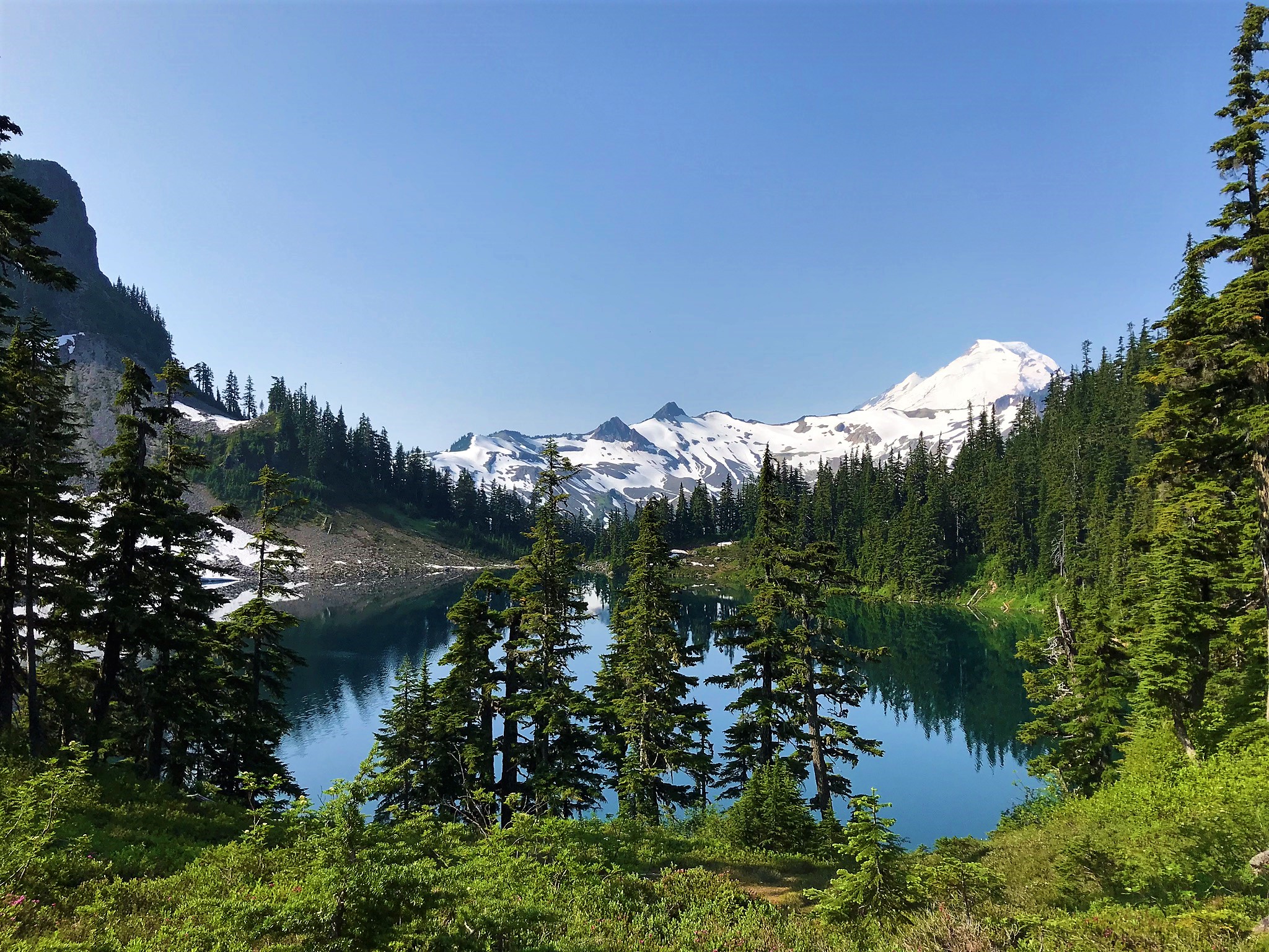
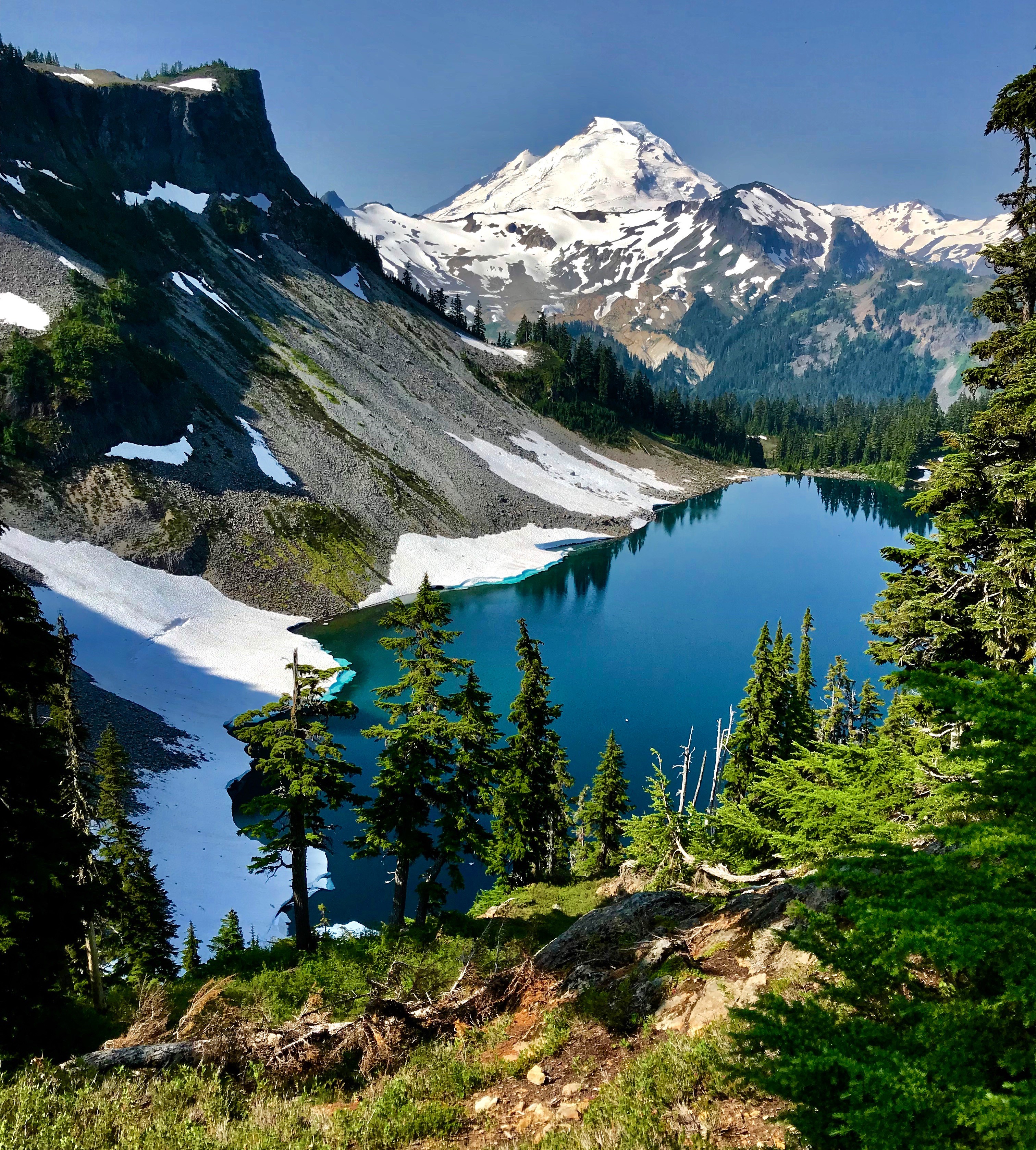
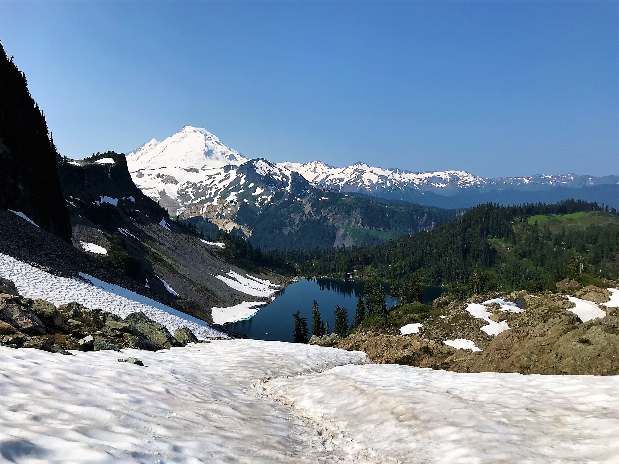
As we moved on from Mazama Lake we climbed up over a ridge to Iceburg Lake. Which is so named because…wait for it… it has iceburgs floating in it. I had read about this ahead of time and was a skeptic, but sure enough there were a few chunks of ice floating around in it. Not only were there chunks of ice floating around in it there were still significant snow fields at the bottom of the scree coming off of table mountain that extended into the lake, a sign of the amount of snow that must fall here during the winter storms.
Hiking into camp at Hayes Lake
As we came to the next set of campsites we met up with our friends, they had saved us some campsites and we set up for the night. The mosquitoes were out in force but the scenery was so gorgeous that it was easy to overlook them. The lake we were at was full of fish rising to the surface and colored with that wonderful blue green color of alpine lakes. Being late July it was a hot day and while it had cooled down some as the evening came on Charissa and Zach were itching to go for a swim in the lake. I being the wary traveler that from experience had found that most lakes that looked like this were also bone chillingly cold decided to forego the aquatics.
The Views!
They found a rocky out cropping that they could jump from and jumped in. They reported that the water was a pleasant temperature and swam for a while, I enjoyed watching them and had I not been so tired would have joined in. Kassie, joined in with them, since she apparently didn’t bring a swim suit she just jumped in in her clothes. Sometimes it’s good to be young.
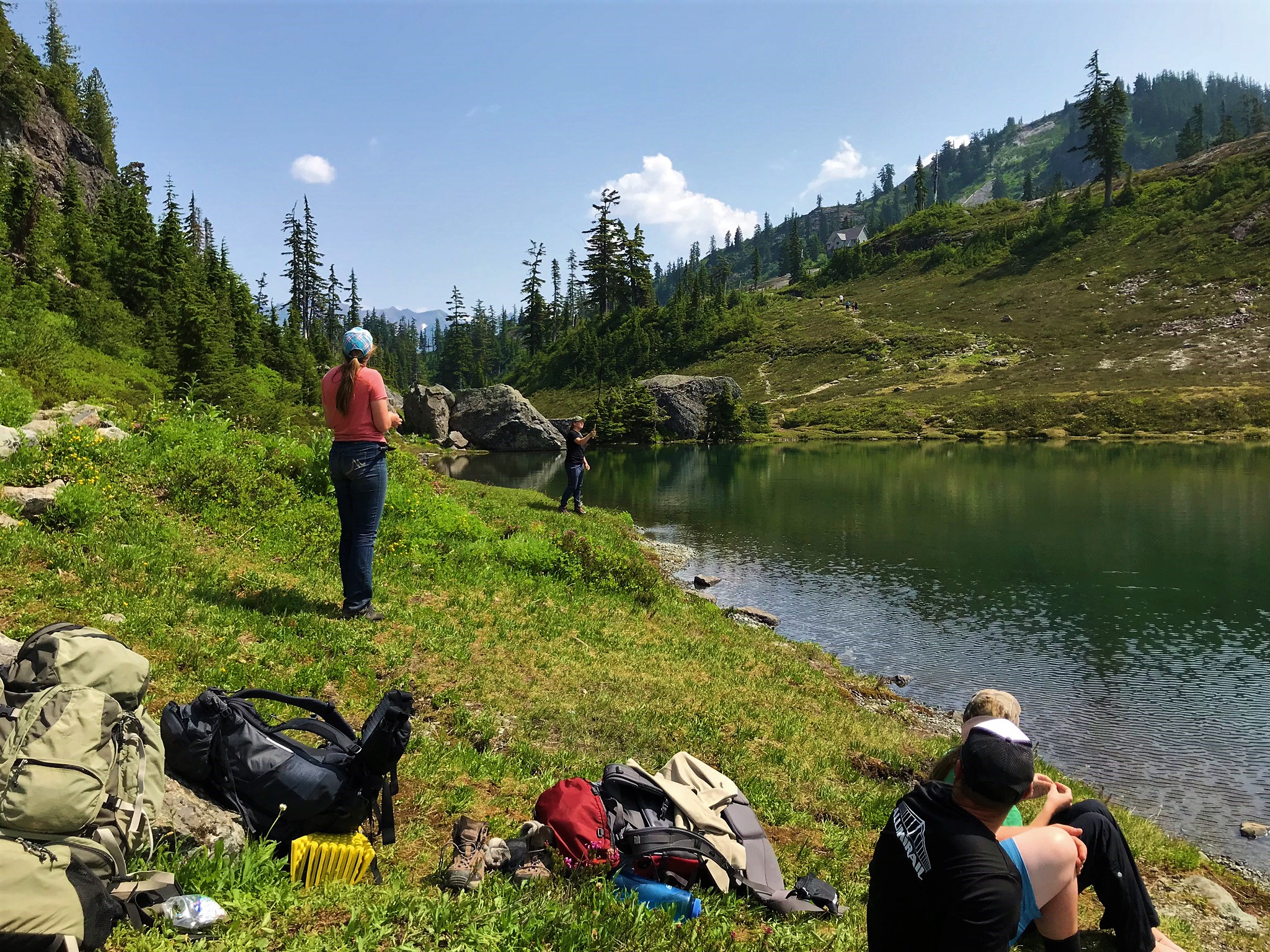
As we were heading back up to the campsite we passed Rachel who was headed down to the lake to fish. I had brought a couple of tenkara fly fishing rods and she was going to go down and try her hand at it. She was down there until it was too dark to see casting away.
Iceberg Lake and Mt Baker, anybody want to go sledding?
The evening was warm, I had hoped we would see stars and that I would have the opportunity to do some night photography, in fact to that end I had hauled up my large digital camera, however we were unfortunate in 2 regards, first there was a layer of smoke that had moved in with the jet stream from forest fires in Siberia, apparently about 38,000 square miles of taiga forest had burnt and secondly as luck would have it it was the Super Moon. While we never saw the moon from our campsite due to the hill blocking it, it was quite a bright night.
First thing in the morning Rachel snuck down to the lake to fish. There was a squeal as she caught her first fish. Zach and I joined her shortly thereafter. It was a beautiful summer morning and in just an amazing setting, alpine lakes, blue skies, and green forests. We fished for a while with little success in the catching, as the fish were just beyond our reach, but well rewarded by the experience of being there.
I just can’t get enough of this view!
As we had some miles yet to put behind us we soon broke camp and moved on. Leaving the lakes we climbed to another pass above Iceberg lake with amazing views of the lake and Mt baker behind it. Again at the pass we encountered snow, deep snow, that made route finding difficult. As came over the top of the pass we did in fact loose the trail. We could see where the trail came up the valley below us and made a traverse across the snow field to where we could intersect it and continue on.
We continued on down the valley to Bagley Lake. This part seemed to take forever, of course it was all down hill and in the sun. By the time we got to Bagley lake we were hot and tired (at least my feet were from all the down hill pounding). Bagley lake looked inviting with its crystal clear waters and after Charissa and Zach had had such a good time swimming in the lake where we camped the night before I decided to jump in.
Mt Shuksan
WOW it was cold! I am not sure I have ever swam in a lake that cold. The creeks we swim in on the Hidden Lakes hike are cold, but this was to a whole different level. I swam out maybe 50 feet or so and back and promptly got out. After warming up a little bit on the shore decided to give it a second go. It was so cold that it was literally painful everywhere that had been submerged.
From Bagley Lake it was about 1/4 mile up to the lower parking lot and then another 1000′ gain and one mile to the Artist Point parking lot. As we climbed back up the views of the basin below with Bagley lake below and a view of the trail we had just come down were stunning. At the top of the trail we were back on snow fields for the last 1/4 mile or so to the parking lot.
Learning to fly fish at Bagley Lake
Beta
Artist Point is a well known and heavily used area. While we did not find there to be excessive people on the trail and at the lakes on Friday night there were signs that the trail (especially the loop) is well traveled. Saturday we did find a lot of people on the trail, especially as the day wore on. The bulk of those were near the parking areas at Bagley Lake and Artist Point, we did pass a few people that were hiking the same loop as a day hike.
This can be done as an easy overnighter by going in from Artist Point and back out the way you came. The views will still be spectacular you just won’t do as much vertical. This is a better option if you have knee or feet issues that are exacerbated by excessive downhill pounding.
If you are looking for a more strenuous uphill route i.e. as a mountaineering prep or otherwise you could start from Heather Meadows or Bagley lake and go up to the lakes.
Table Mountain and Bagley Lakes from the trail back up to Artist Point
We used Green Trails Map 13SX which is the large map for the Mt. Baker Area, Green Trails map 14 Mt. Shuksan also has the trail system on it.
The mileage breakdown is as follows for the route as we did it: 1.1 miles from the Artist Point parking lot to the saddle at Ptarmigan Ridge. 0 .8 miles from the saddle to Mazama Lake (where there are 4 campsites available), 0.4 miles from Mazama Lake to the Hayes Lake junction, we hiked maybe another 1/4 mile or less to our campsite at Hayes Lake. From the junction at Hayes Lake it is .9 miles to Hermann Saddle. From Hermann Saddle it is 1.8 miles down to the bridge at Bagley Lakes. The next part is not clear on the maps but I would say it is about 0.25 miles from the bridge to the Bagley Lakes parking area and then about a mile from the Bagley Lakes parking area to the Artist Point parking area. That makes for roughly 6.35 miles round trip. You can extend that by hiking around the lower Bagley Lakes section.
We originally intended to go to Early Winters Creek Campground in Mazama but were delayed in getting out of town. I had really hoped we would get a spot at Early Winters Creek, it is only about 15 miles or so from Washington Pass and I wanted to give the splitboard I just finished putting together a go but when we finally did get to Mazama all the campgrounds were full so we headed out to Winthrop and up towards Billy Goat Mountain until we found a spot.
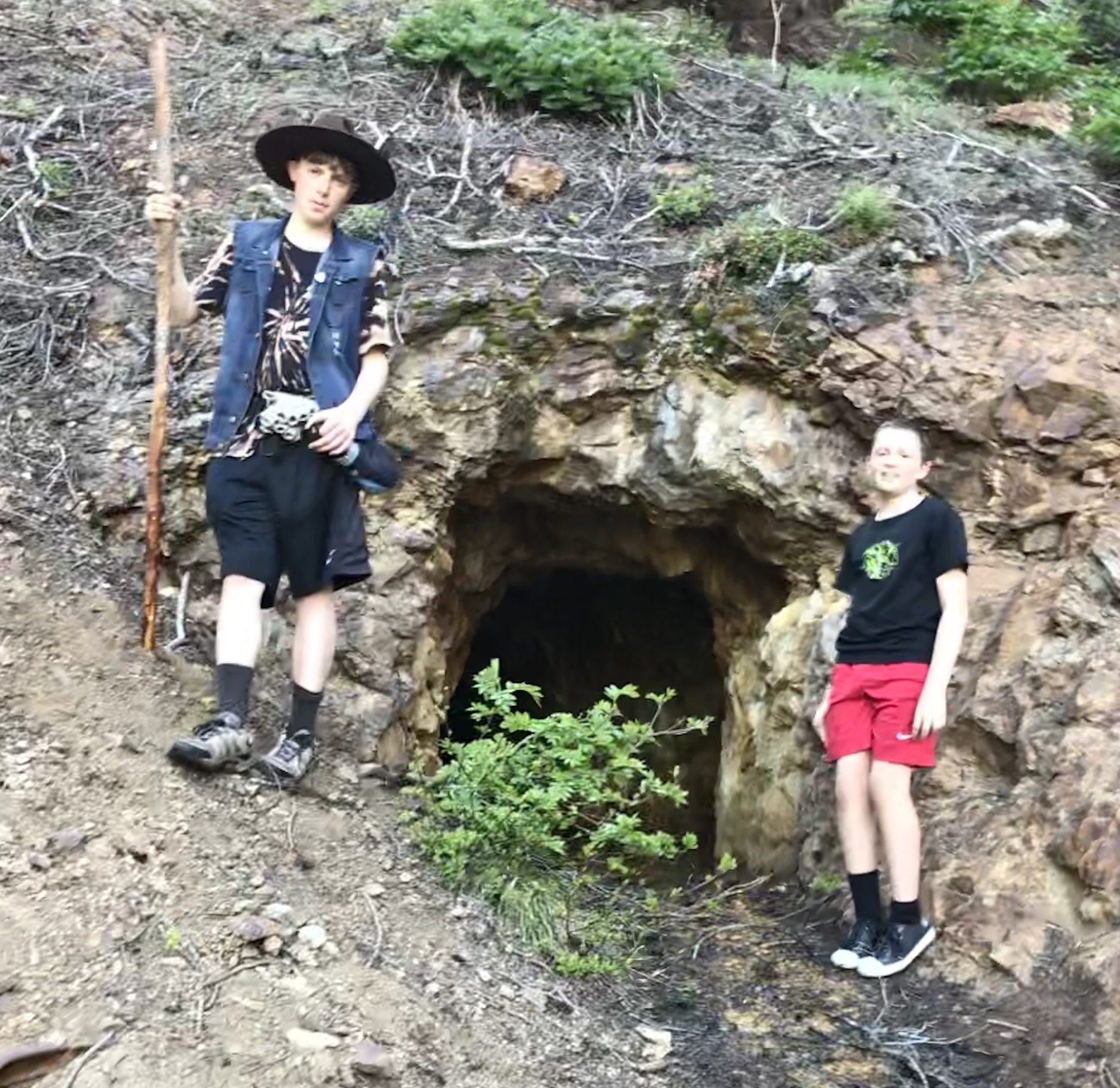
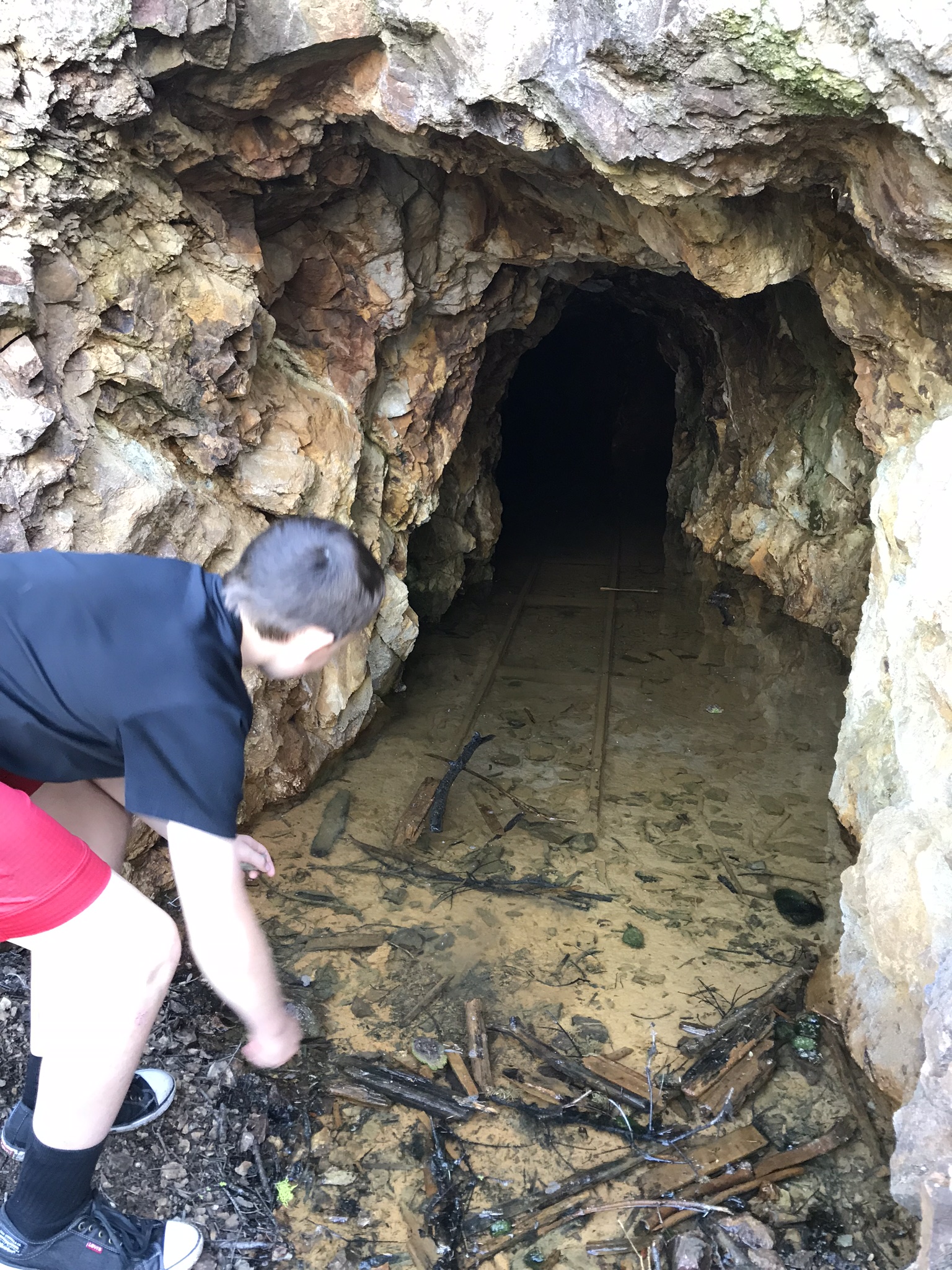
Gordon and Zach at Upper Copper Glance Mine
One of the routes that I like to take youth groups backpacking on is a loop from Billy Goat Mountain around to the Hidden Lakes via Dollar Watch Mountain and back to Billy Goat. In 2017 there was a wildfire in that area that burned over 128,000 acres. I was (and still am) concerned about the how the fire affected the areas we like to hike through. Part of the reason for my concern is that there is a section of trail from Dollar Watch Mountain to Big Hidden Lake that had previously burnt out about 18 years ago and had become a miserable slog through overgrown underbrush and blowdowns. I am holding out some hope that the areas that burnt in 2017 won’t be as bad as the other area, due to the forests in most of those areas being in better shape than the area that had previously burnt which been affected by beetle kill and the forest there was already largely dead when the fire came through with devastating effect.
Zach taking a look into Copper Glance Mine, note the old narrow gauge rails.
Since we were in the area I decided we would head up and hike up to Drake Creek or up to Billy Goat Pass, however it was not to be as the road was closed a couple miles before the trailhead with a sign that indicated closed meant closed to everybody not just vehicles. The closure was just past the Copper Glance trail so we decided instead to go up Copper Glance. I had thought I left the maps in the trailer back at camp so we went from what I could remember, that roughly we’d go up 2000′ and the trail was a couple of miles long. No big deal…
The first mile or so wandered through the woods up an old mine railway grade, eventually coming to an abandoned mine. It is a nice broad trail that while continually going up was not too steep (rail grade), there was a creek crossing that had Charissa a little concerned but none the less a pretty easy jaunt up to the mine. After the mine the trail steepens as you climb through the forest, I was beginning to wonder if we were going to break out of the trees and get a view when suddenly we came up around a bend and were rewarded with this amazing view (thank you to the other hikers that said keep going it is worth it, not that we would have stopped but it is nice to have some encouragement).
You come wandering out of the woods to an immense wall of stone and ice
We continued to hike through the meadows enjoying the alpine views when shortly we began to come into some snow. As we entered back into the trees the snow became heavier and heavier making trail finding difficult. Eventually we came to a creek that looked like it would require a pretty significant effort to cross and we were pretty much on solid snow by then. As we had started out for just a leisurely stroll through the woods we weren’t really equipped to be roaming around in the snow and decided that it would be a good time to turn back. It of course was a hard decision as there is a lake up there that I really would have liked to reach even though chances are it was probably still snowed in or frozen over, but Zach was wearing converse tennis shoes that were soaked through and like I said we didn’t have the map with us…
We hit snow!
Zach, Gordon, and Skyler taking a break down near the Creek where we turned around
A couple of things about this hike:
While I don’t remember now how long we were up there I kept wondering why we hadn’t reached the lake, I could remember that it was about a 2000′ vertical gain and had been consistently hiking at a 1000′ plus gain per hour on other recent hikes (I know because we were measuring for that in preparation for a Mt. Baker climb) and we had been hiking for more than a couple hours. Turns out that on the map the trail doesn’t start from the road (like it does in reality). The map shows a road that goes in, probably about to the mine, then the trail starts. It shows the trail starting at 5000′ going up to 6200 feet in 1.8 miles and then dropping to 6100 feet in another .5 miles to the lake. The elevation of the road at the junction of road 5130 and 505 (which is really the trailhead) is 3840′. We made it up to 6,080 feet. Washington Trails Association puts the hike up to the mines at about 1.5 miles.
After returning to the car, and somewhat ironically, I found that I had not left the maps at camp but that they were in fact in the car….. Oh well maybe we’ll get to go back although as I wrote this the fire map shows that the Mcleod fire has reached the trail head and part of the trail.
While we didn’t plan on doing this particular trail and in fact had no intention of being in the area, it was a really enjoyable hike that I’m excited to go back and do when we can get to the lake. Sometimes you just get lucky 🙂
Charissa taking a break on the way down to admire the view of Isabella Ridge and listen to the Wood Peckers
Trail Beta: Copper Glance Trail is Trail 519, off of Rd 505 (which is closed) take Road 5130 to get there, there are signs on the road. Use green trails maps 19 Billy Goat Mountain and 51 Mazama